Rune-stone Vg179, L1965:4198 in Kölaby parish, Ulricehamn municipality
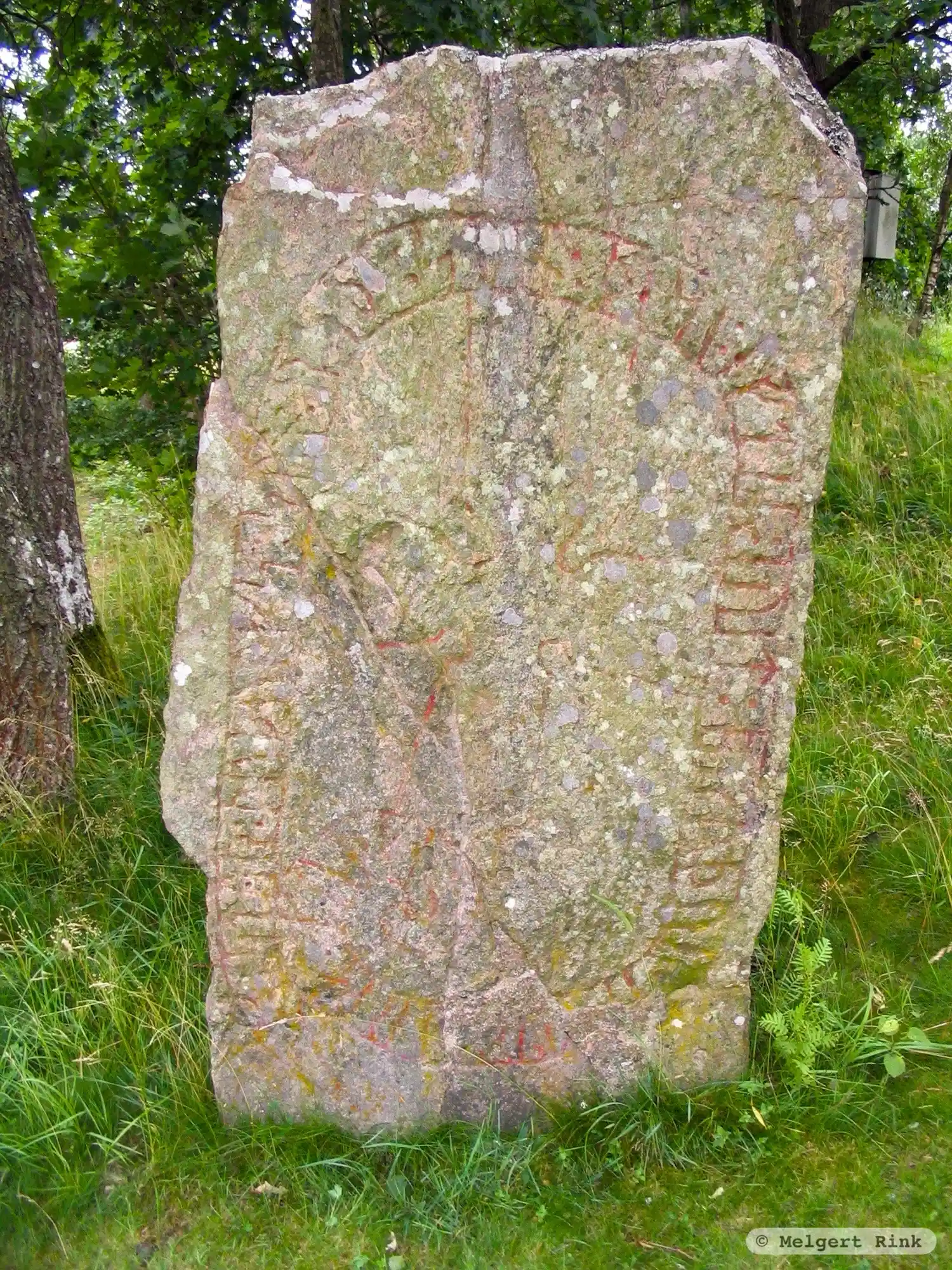
Photo: Melgert Rink
Runic inscription
: styr : þuþulfs : sun : rsþi : stin : þesi : eftiR : euit : bruþur : s-- trk hrþa : kuþan :
Inscription
: styr : þuþulfs : sun : rsþi : stin : þesi : eftiR : euit : bruþur : s-- trk hrþa : kuþan :
Translation
Styrr, Þjóðulfr's son, raised this stone in memory of Eyvindr, his brother, a very good valiant man.
Find the carving
Rune-stone Vg179, L1965:4198 in Kölaby parish, Ulricehamn municipality
Facts
| Monument number | L1965:4198 |
|---|---|
| Swedish National Heritage Board ID | Kölaby 30:2 |
| Status | Confirmed on location |
| Place | Visible above ground |
| Antiquarian assessment | Possible ancient monument |
| Damage status | Undamaged |
| County | Västra Götaland |
| Municipality | Ulricehamn |
| Parish | Kölaby |
| Coordinates | 57.9878825, 13.540634 |
Sources
Most of the factual information in Runkartan comes from the Swedish National Heritage Board’s Fornsök data and from the Scandinavian Runic Text Database. The maps come from OpenStreetMap and Leaflet.js. The photographs were taken by the credited photographers.