Rune-stone UFv1958;250, L2015:2185 in Sigtuna parish, Sigtuna municipality
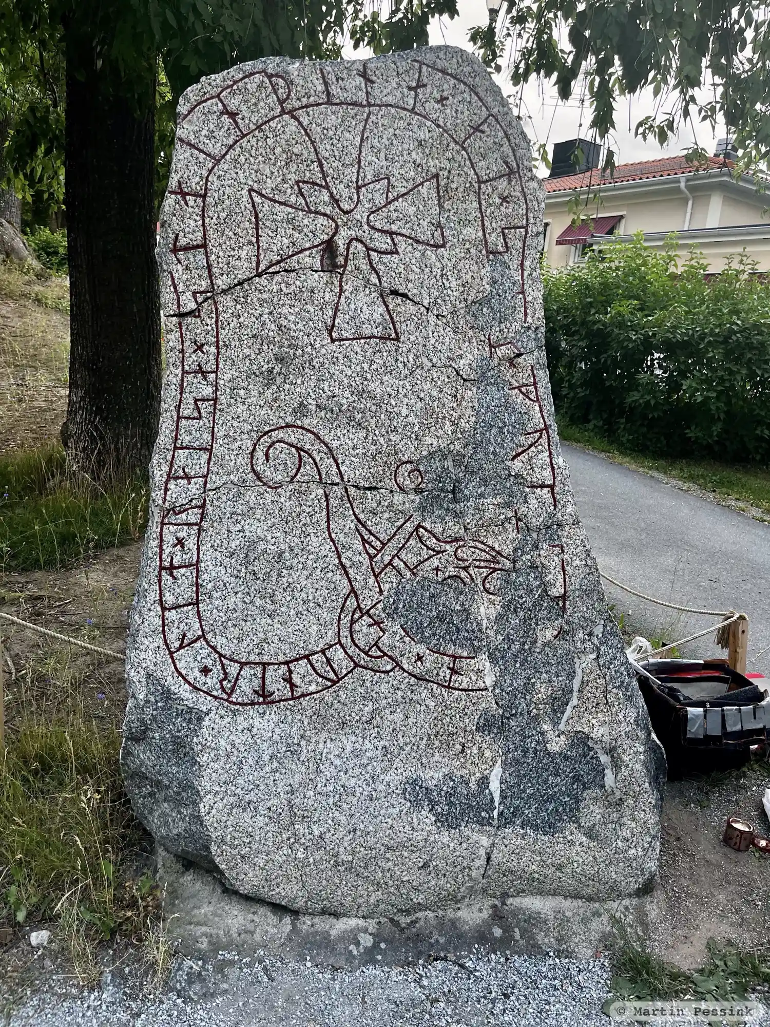
Photo: Martin Pessink
Runic inscription
× ...nuntr × lit × raisa × stain þina × at × s(i)(k) × kuik-...n ×
Inscription
× ...nuntr × lit × raisa × stain þina × at × s(i)(k) × kuik-...n ×
Translation
Ônundr had this stone raised in memory of himself while alive.
Find the carving
Rune-stone UFv1958;250, L2015:2185 in Sigtuna parish, Sigtuna municipality
Facts
| Monument number | L2015:2185 |
|---|---|
| Swedish National Heritage Board ID | Sigtuna 11:3 |
| Carver | Fot 2 (A); Torgöt Fotsarve (A) |
| Status | Confirmed on location |
| Place | Visible above ground |
| Material | Granite |
| Antiquarian assessment | Ancient monument |
| Damage status | Unknown |
| County | Stockholm |
| Municipality | Sigtuna |
| Parish | Sigtuna |
| Coordinates | 59.617003, 17.720472 |
Sources
Most of the factual information in Runkartan comes from the Swedish National Heritage Board’s Fornsök data and from the Scandinavian Runic Text Database. The maps come from OpenStreetMap and Leaflet.js. The photographs were taken by the credited photographers.