Rune-stone U828, L1943:4373 in Fittja parish, Enköping municipality
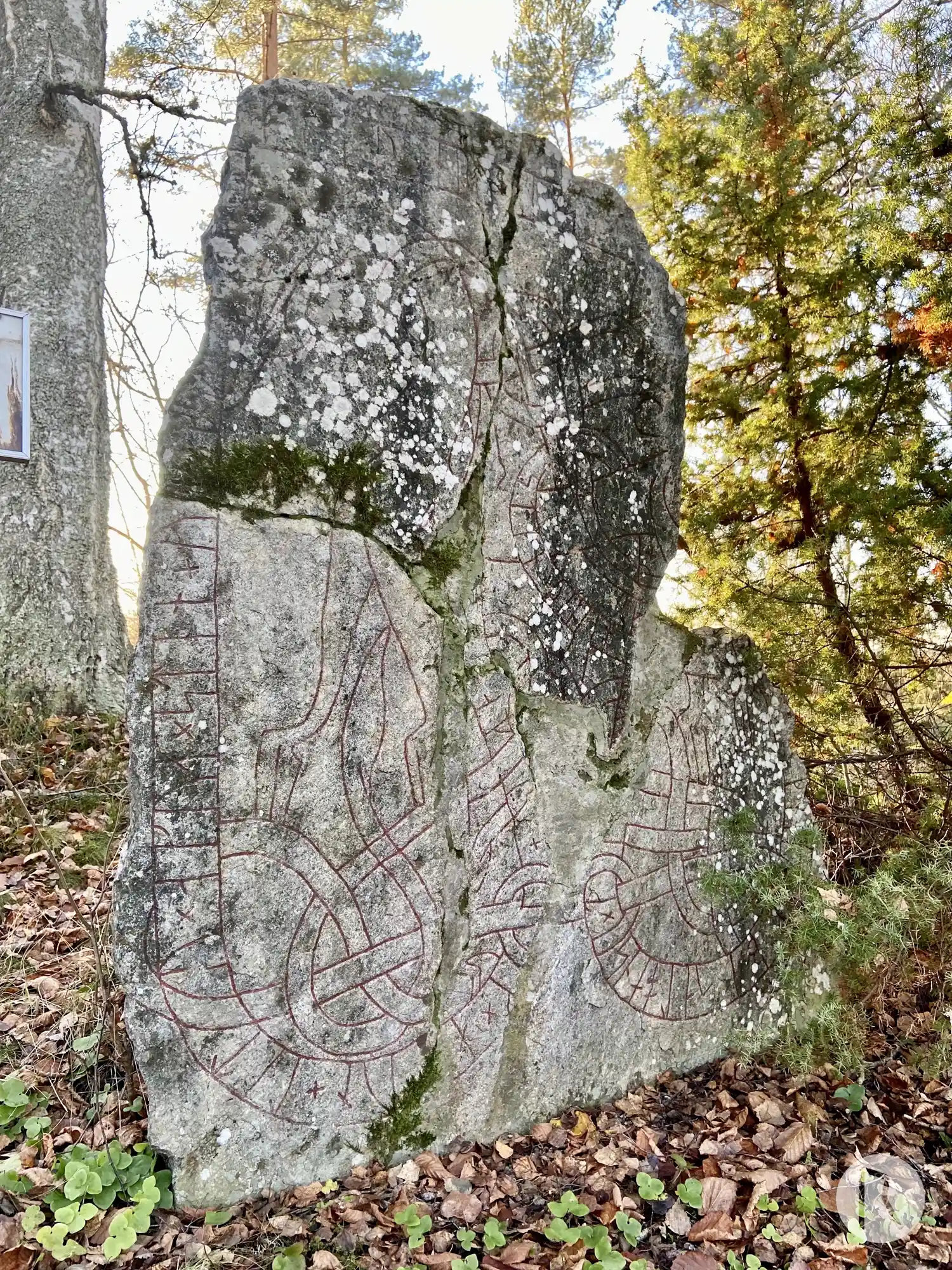
Photo: Niklas Vackerdag
Runic inscription
kakr × uk × a[k]un × litu × akua × sten × uk × br[u × kira × u]ftir × ernisl [× faþur + sin × kuþan × ku]þ × ialbi salo ans × t(i)[þk]umi [×] uk × sten × þino
Inscription
kakr × uk × a[k]un × litu × akua × sten × uk × br[u × kira × u]ftir × ernisl [× faþur + sin × kuþan × ku]þ × ialbi salo ans × t(i)[þk]umi [×] uk × sten × þino
Translation
Kagr(?)/Gagr(?) and Hákon had the stone cut and the bridge made in memory of Erngísl, their good father. May God help his soul. Tíðkumi cut this stone.
Find the carving
Rune-stone U828, L1943:4373 in Fittja parish, Enköping municipality
Facts
| Monument number | L1943:4373 |
|---|---|
| Swedish National Heritage Board ID | Fittja 1:1 |
| Carver | Tidkume (S); (Ödkume (S), felaktig attribution av Brate.); tillsammans med Livsten (A) [Stille 1999b] |
| Status | Confirmed on location |
| Place | Visible above ground |
| Material | Granite |
| Antiquarian assessment | Ancient monument |
| Damage status | Damage |
| County | Uppsala |
| Municipality | Enköping |
| Parish | Fittja |
| Coordinates | 59.715628, 17.442058 |
Sources
Most of the factual information in Runkartan comes from the Swedish National Heritage Board’s Fornsök data and from the Scandinavian Runic Text Database. The maps come from OpenStreetMap and Leaflet.js. The photographs were taken by the credited photographers.