Rune-stone U658, L2016:2191 in Håtuna parish, Upplands-Bro municipality
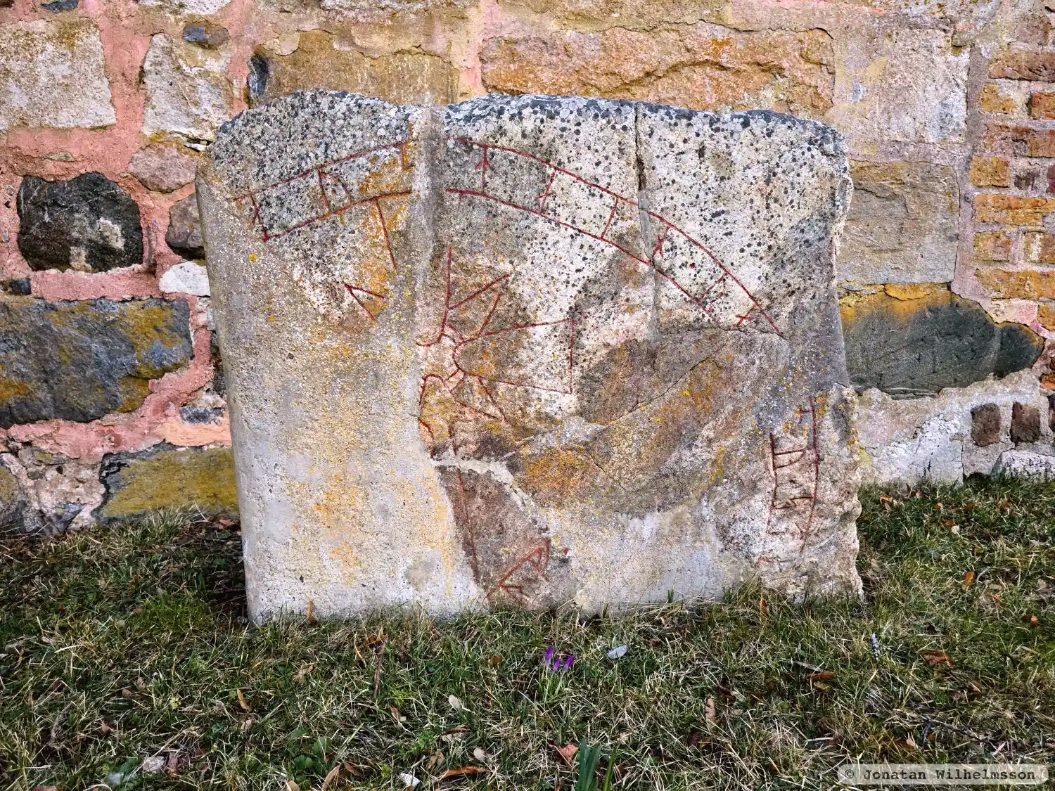
Photo: Jonatan Wilhelmsson
Runic inscription
... aystain · ra[is](t)u · st[ai]n [· þin · at · -]...ar · f(a)[þur · sin]
Inscription
... aystain · ra[is](t)u · st[ai]n [· þin · at · -]...ar · f(a)[þur · sin]
Translation
... Eysteinn raised this stone in memory of ... their father.
Find the carving
Rune-stone U658, L2016:2191 in Håtuna parish, Upplands-Bro municipality
Facts
| Monument number | L2016:2191 |
|---|---|
| Swedish National Heritage Board ID | Håtuna 12:1 |
| Status | Confirmed on location |
| Place | In building or under water |
| Material | Micaceous gneiss |
| Period | Viking age |
| Antiquarian assessment | Ancient monument |
| Damage status | Damage |
| County | Stockholm |
| Municipality | Upplands-Bro |
| Parish | Håtuna |
| Coordinates | 59.623081, 17.609114 |
Sources
Most of the factual information in Runkartan comes from the Swedish National Heritage Board’s Fornsök data and from the Scandinavian Runic Text Database. The maps come from OpenStreetMap and Leaflet.js. The photographs were taken by the credited photographers.