Rune-stone U586, L2017:4991 in Edsbro parish, Norrtälje municipality
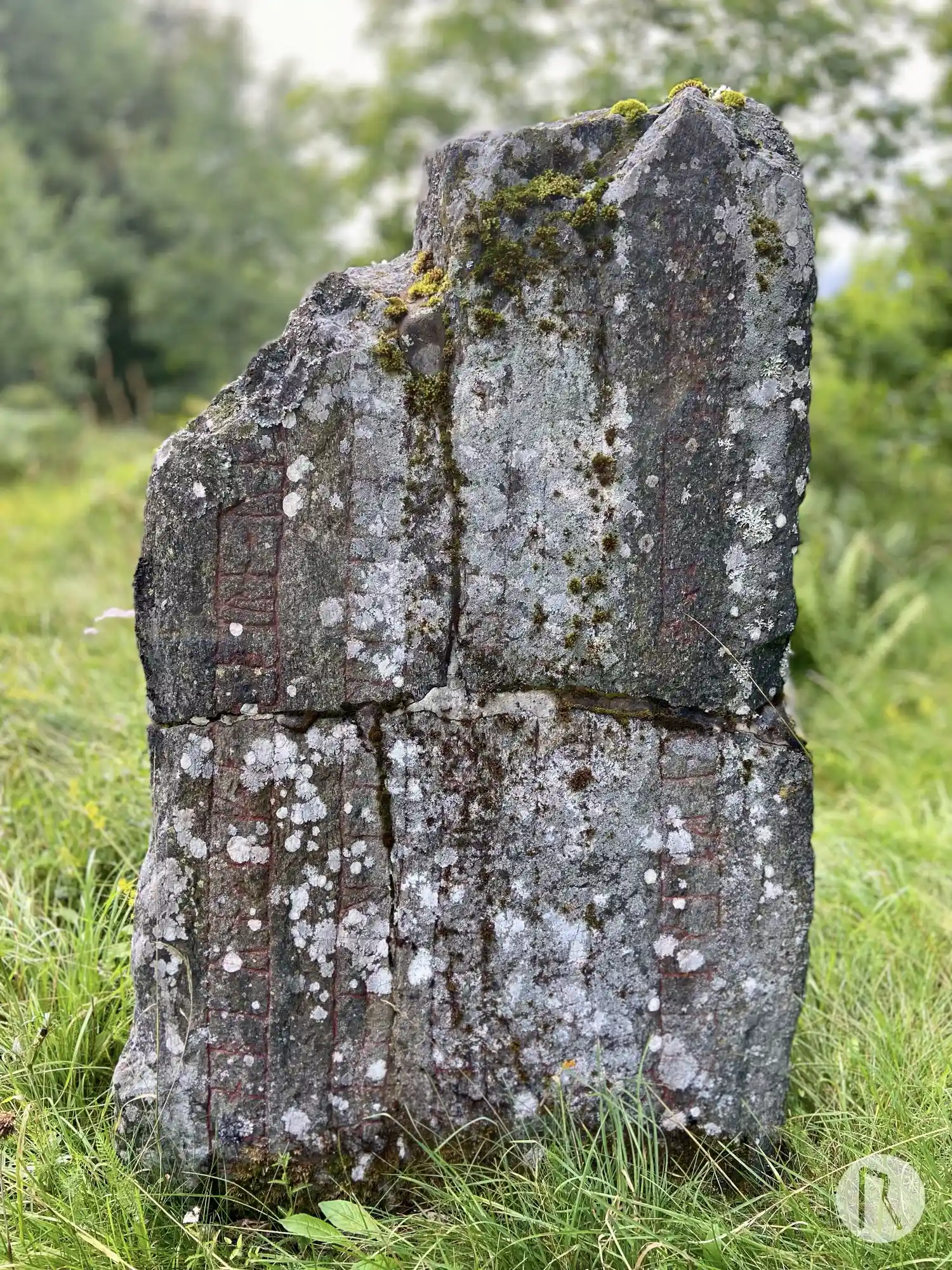
Photo: Niklas Vackerdag
Runic inscription
× kunbirn × uk × osbirn × uk × [sikuatr · þiR × lit](u) [×] (r)(i)sa × s[t](i)(n) × [þin]a × iftiR × t(u)ka × faþur sin × ku[þ](a)(n) × ku(þ) ial(b)[i × ans × -]t uk × salu bitr × þan × an × karþi × til × ulm×f(r)[i](R) lit × kra br(u)
Inscription
× kunbirn × uk × osbirn × uk × [sikuatr · þiR × lit](u) [×] (r)(i)sa × s[t](i)(n) × [þin]a × iftiR × t(u)ka × faþur sin × ku[þ](a)(n) × ku(þ) ial(b)[i × ans × -]t uk × salu bitr × þan × an × karþi × til × ulm×f(r)[i](R) lit × kra br(u)
Translation
Gunnbjôrn and Ásbjôrn and Sighvatr, they had this stone raised in memory of Tóki, their good father. May God help his spirit and soul better than he deserved. Holmfríðr had the bridge made.
Find the carving
Rune-stone U586, L2017:4991 in Edsbro parish, Norrtälje municipality
Facts
| Monument number | L2017:4991 |
|---|---|
| Swedish National Heritage Board ID | Edsbro 227:1 |
| Carver | Gunnar (A) |
| Status | Confirmed on location |
| Place | Visible above ground |
| Material | Granite |
| Period | Viking age |
| Antiquarian assessment | Ancient monument |
| Damage status | Damage |
| County | Stockholm |
| Municipality | Norrtälje |
| Parish | Edsbro |
| Coordinates | 59.89317, 18.475253 |
Sources
Most of the factual information in Runkartan comes from the Swedish National Heritage Board’s Fornsök data and from the Scandinavian Runic Text Database. The maps come from OpenStreetMap and Leaflet.js. The photographs were taken by the credited photographers.