Rune-stone U449, L2016:4550 in Odensala parish, Sigtuna municipality
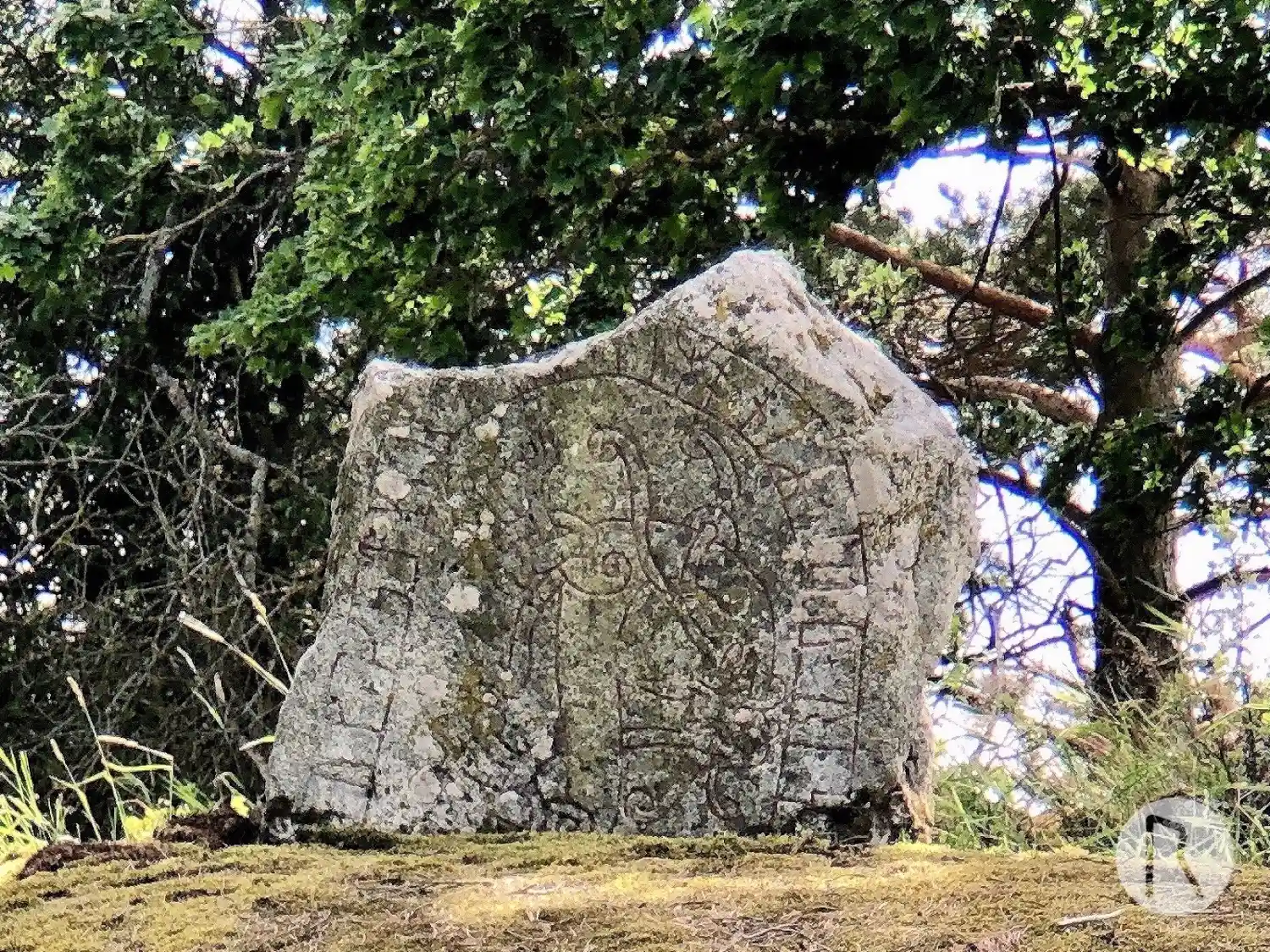
Photo: Niklas Vackerdag
Runic inscription
... (a)uk + fstkir + a(u)- (u)imontR + litu + ris... ...
Inscription
... (a)uk + fstkir + a(u)- (u)imontR + litu + ris... ...
Translation
... and Fastgeirr/Fastgerðr and Vémundr had raised ...
Find the carving
Rune-stone U449, L2016:4550 in Odensala parish, Sigtuna municipality
Facts
| Monument number | L2016:4550 |
|---|---|
| Swedish National Heritage Board ID | Odensala 116:2 |
| Carver | Visäte (A) [Thompson 1975:80 not 10, Larsson 2002:69 not 52] |
| Status | Confirmed on location |
| Place | Visible above ground |
| Material | Granite |
| Antiquarian assessment | Possible ancient monument |
| Damage status | Unknown |
| County | Stockholm |
| Municipality | Sigtuna |
| Parish | Odensala |
| Coordinates | 59.680955, 17.863905 |
Sources
Most of the factual information in Runkartan comes from the Swedish National Heritage Board’s Fornsök data and from the Scandinavian Runic Text Database. The maps come from OpenStreetMap and Leaflet.js. The photographs were taken by the credited photographers.