Rune-stone U393, L2015:2362 in Sigtuna parish, Sigtuna municipality
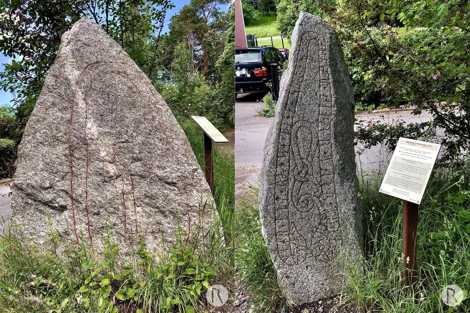
Photo: Niklas Vackerdag
Runic inscription
ufihr × lit × raisa + þina + stin × aftR × sestr + sinar + tuar × tura × auk ruþui
Inscription
ufihr × lit × raisa + þina + stin × aftR × sestr + sinar + tuar × tura × auk ruþui
Translation
Ófeigr had this stone raised in memory of his two sisters Tóra(?) and Hróðvé.
Find the carving
Rune-stone U393, L2015:2362 in Sigtuna parish, Sigtuna municipality
Facts
| Monument number | L2015:2362 |
|---|---|
| Swedish National Heritage Board ID | Sigtuna 23:1 |
| Carver | Visäte (A) [Källström 1999:113f] |
| Status | Confirmed on location |
| Place | Visible above ground |
| Material | Granite |
| Period | Viking age |
| Antiquarian assessment | Ancient monument |
| Damage status | Unknown |
| County | Stockholm |
| Municipality | Sigtuna |
| Parish | Sigtuna |
| Coordinates | 59.61702, 17.715947 |
Sources
Most of the factual information in Runkartan comes from the Swedish National Heritage Board’s Fornsök data and from the Scandinavian Runic Text Database. The maps come from OpenStreetMap and Leaflet.js. The photographs were taken by the credited photographers.