Rune-stone U353, L2016:5843 in Lunda parish, Sigtuna municipality
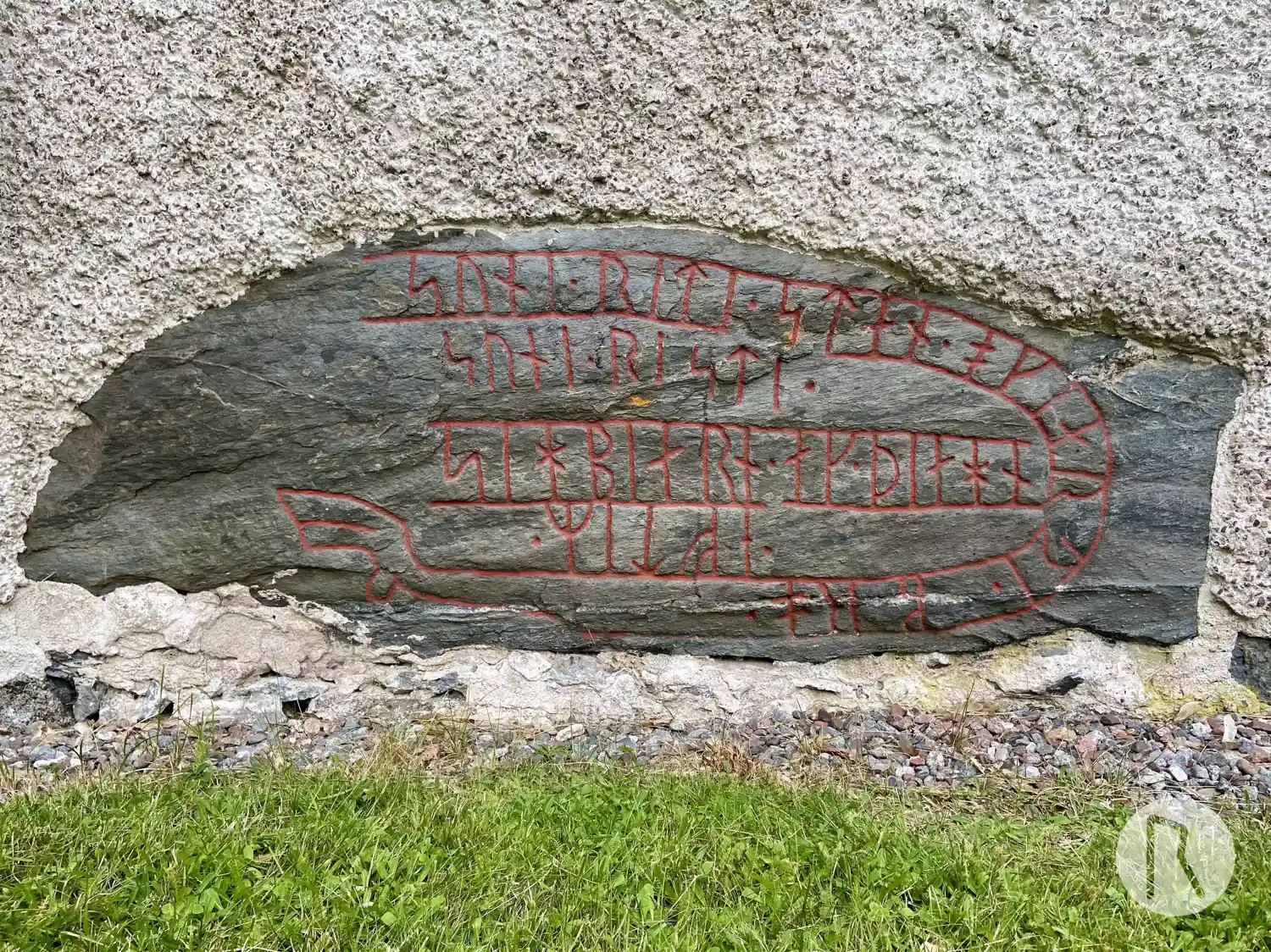
Photo: Niklas Vackerdag
Runic inscription
suni · riti · stan · ok| |kiarþi · bro ·· eftiR · sihbiarn · ak · þiahn suni · risti ·
Inscription
suni · riti · stan · ok| |kiarþi · bro ·· eftiR · sihbiarn · ak · þiahn suni · risti ·
Translation
Soni erected the stone and made the bridge in memory of Sigbjôrn and Þegn. Soni carved.
Find the carving
Rune-stone U353, L2016:5843 in Lunda parish, Sigtuna municipality
Facts
| Monument number | L2016:5843 |
|---|---|
| Swedish National Heritage Board ID | Lunda 17:1 |
| Carver | Sune (S) |
| Status | Confirmed on location |
| Place | Visible above ground |
| Material | Schist |
| Antiquarian assessment | Ancient monument |
| Damage status | Undamaged |
| County | Stockholm |
| Municipality | Sigtuna |
| Parish | Lunda |
| Coordinates | 59.666784, 18.046119 |
Sources
Most of the factual information in Runkartan comes from the Swedish National Heritage Board’s Fornsök data and from the Scandinavian Runic Text Database. The maps come from OpenStreetMap and Leaflet.js. The photographs were taken by the credited photographers.