Rune-stone U326, L2016:6914 in Markim parish, Vallentuna municipality
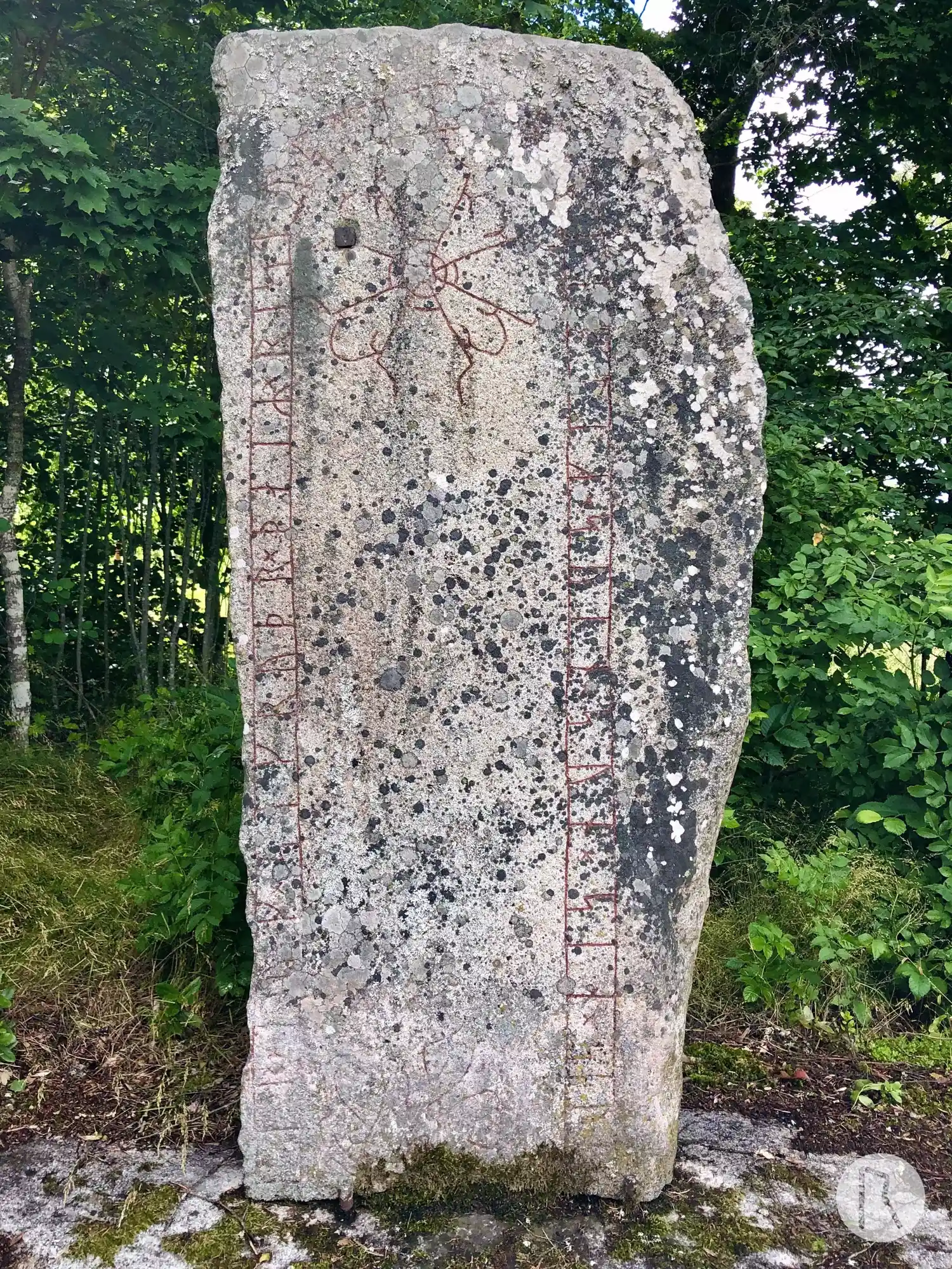
Photo: Niklas Vackerdag
Runic inscription
[hulm]kir × auk × sikruþr × þaiR × ristu × stina × þisi × eftiR × suin × sun × sin × siþ×bu[rin]
Inscription
[hulm]kir × auk × sikruþr × þaiR × ristu × stina × þisi × eftiR × suin × sun × sin × siþ×bu[rin]
Translation
Holmgerðr/Holmgeirr and Sigrøðr/Sigþrúðr, they raised these stones in memory of Sveinn, their son, the late-born.
Find the carving
Rune-stone U326, L2016:6914 in Markim parish, Vallentuna municipality
Facts
| Monument number | L2016:6914 |
|---|---|
| Swedish National Heritage Board ID | Markim 5:1 |
| Carver | Gunnar (A) |
| Status | Confirmed on location |
| Place | Visible above ground |
| Material | Red granite |
| Period | Viking age |
| Antiquarian assessment | Ancient monument |
| Damage status | Unknown |
| County | Stockholm |
| Municipality | Vallentuna |
| Parish | Markim |
| Coordinates | 59.598633333333, 18.048077833333 |
Sources
Most of the factual information in Runkartan comes from the Swedish National Heritage Board’s Fornsök data and from the Scandinavian Runic Text Database. The maps come from OpenStreetMap and Leaflet.js. The photographs were taken by the credited photographers.