Rune-stone U289, L2017:3910 in Hammarby parish, Upplands Väsby municipality
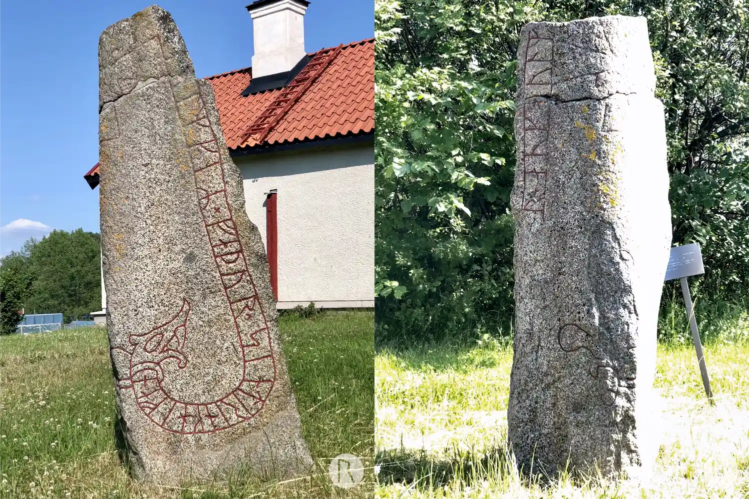
Photo: Niklas Vackerdag
Runic inscription
...r × auk hulm[fastr × litu × risa stina × iftiR ×] (h)ulmkiR × faþur × sin trink hifan
Inscription
...r × auk hulm[fastr × litu × risa stina × iftiR ×] (h)ulmkiR × faþur × sin trink hifan
Translation
... and Holmfastr had the stones raised in memory of Holmgeirr, their father, a competent valiant man.
Find the carving
Rune-stone U289, L2017:3910 in Hammarby parish, Upplands Väsby municipality
Facts
| Monument number | L2017:3910 |
|---|---|
| Swedish National Heritage Board ID | Hammarby 120:1 |
| Status | Confirmed on location |
| Place | Visible above ground |
| Material | Granite |
| Antiquarian assessment | Ancient monument |
| Damage status | Damage |
| County | Stockholm |
| Municipality | Upplands Väsby |
| Parish | Hammarby |
| Coordinates | 59.531675, 17.931903 |
Sources
Most of the factual information in Runkartan comes from the Swedish National Heritage Board’s Fornsök data and from the Scandinavian Runic Text Database. The maps come from OpenStreetMap and Leaflet.js. The photographs were taken by the credited photographers.