Rune-stone U280, L2017:3974 in Hammarby parish, Upplands Väsby municipality
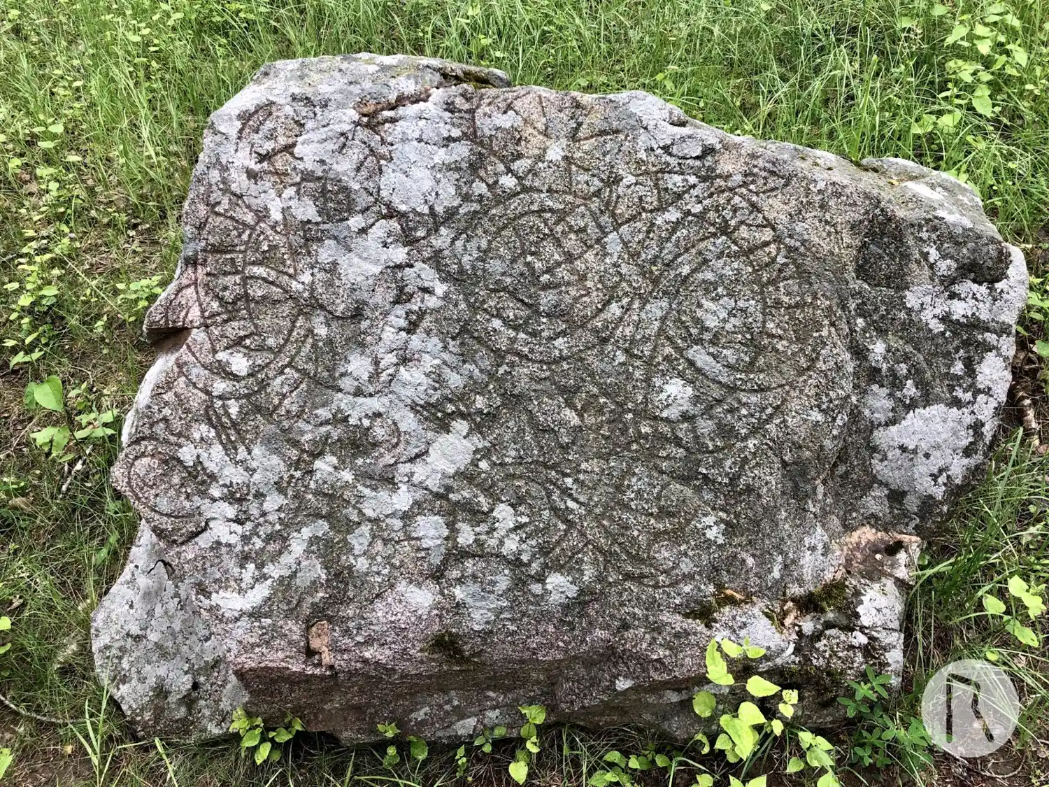
Photo: Niklas Vackerdag
Runic inscription
uibiarn lit · hkua stain · iftiR · kuna totur · kunu sina
Inscription
uibiarn lit · hkua stain · iftiR · kuna totur · kunu sina
Translation
Vébjôrn had the stone cut in memory of Gunni's daughter, his wife.
Find the carving
Rune-stone U280, L2017:3974 in Hammarby parish, Upplands Väsby municipality
Facts
| Monument number | L2017:3974 |
|---|---|
| Swedish National Heritage Board ID | Hammarby 11:1 |
| Status | Confirmed on location |
| Place | Visible above ground |
| Period | Viking age |
| Antiquarian assessment | Ancient monument |
| Damage status | Damage |
| County | Stockholm |
| Municipality | Upplands Väsby |
| Parish | Hammarby |
| Coordinates | 59.5076125, 17.9037355 |
Sources
Most of the factual information in Runkartan comes from the Swedish National Heritage Board’s Fornsök data and from the Scandinavian Runic Text Database. The maps come from OpenStreetMap and Leaflet.js. The photographs were taken by the credited photographers.