Rune-stone U256, L2017:6944 in Fresta parish, Upplands Väsby municipality
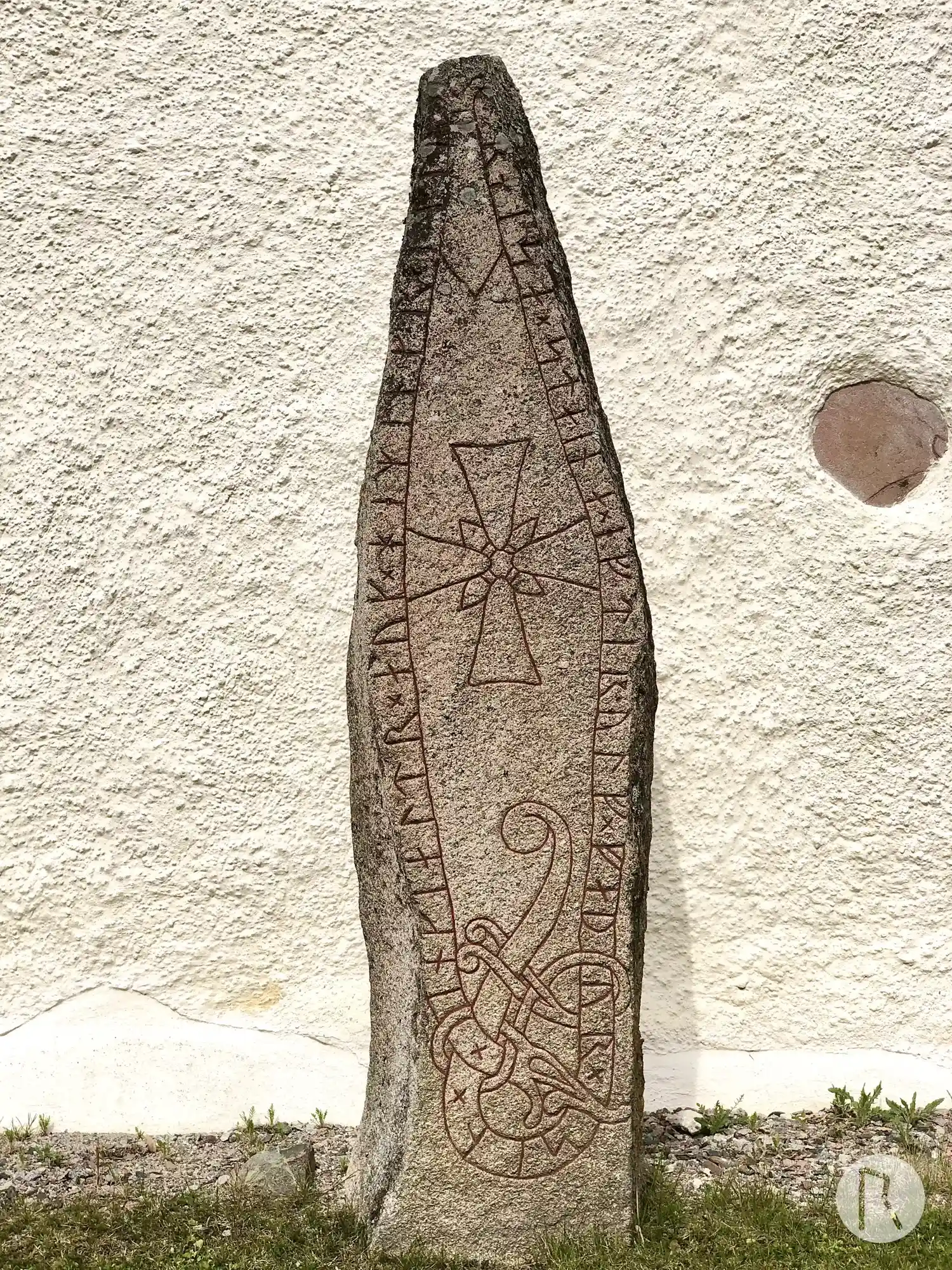
Photo: Niklas Vackerdag
Runic inscription
× inkialtr × auk × heminkr × litu × raisa × staina × eftir · ulf × faþur × sin ×
Inscription
× inkialtr × auk × heminkr × litu × raisa × staina × eftir · ulf × faþur × sin ×
Translation
Ingjaldr and Hemingr had the stones raised in memory of Ulfr, their father.
Find the carving
Rune-stone U256, L2017:6944 in Fresta parish, Upplands Väsby municipality
Facts
| Monument number | L2017:6944 |
|---|---|
| Swedish National Heritage Board ID | Fresta 1:10 |
| Carver | Fot 2 (A) |
| Status | Confirmed on location |
| Place | Visible above ground |
| Material | Granite |
| Period | Viking age |
| Antiquarian assessment | Ancient monument |
| Damage status | Undamaged |
| County | Stockholm |
| Municipality | Upplands Väsby |
| Parish | Fresta |
| Coordinates | 59.517803, 17.957117 |
Sources
Most of the factual information in Runkartan comes from the Swedish National Heritage Board’s Fornsök data and from the Scandinavian Runic Text Database. The maps come from OpenStreetMap and Leaflet.js. The photographs were taken by the credited photographers.