Rune-stone U154, L2014:682 in Täby parish, Täby municipality
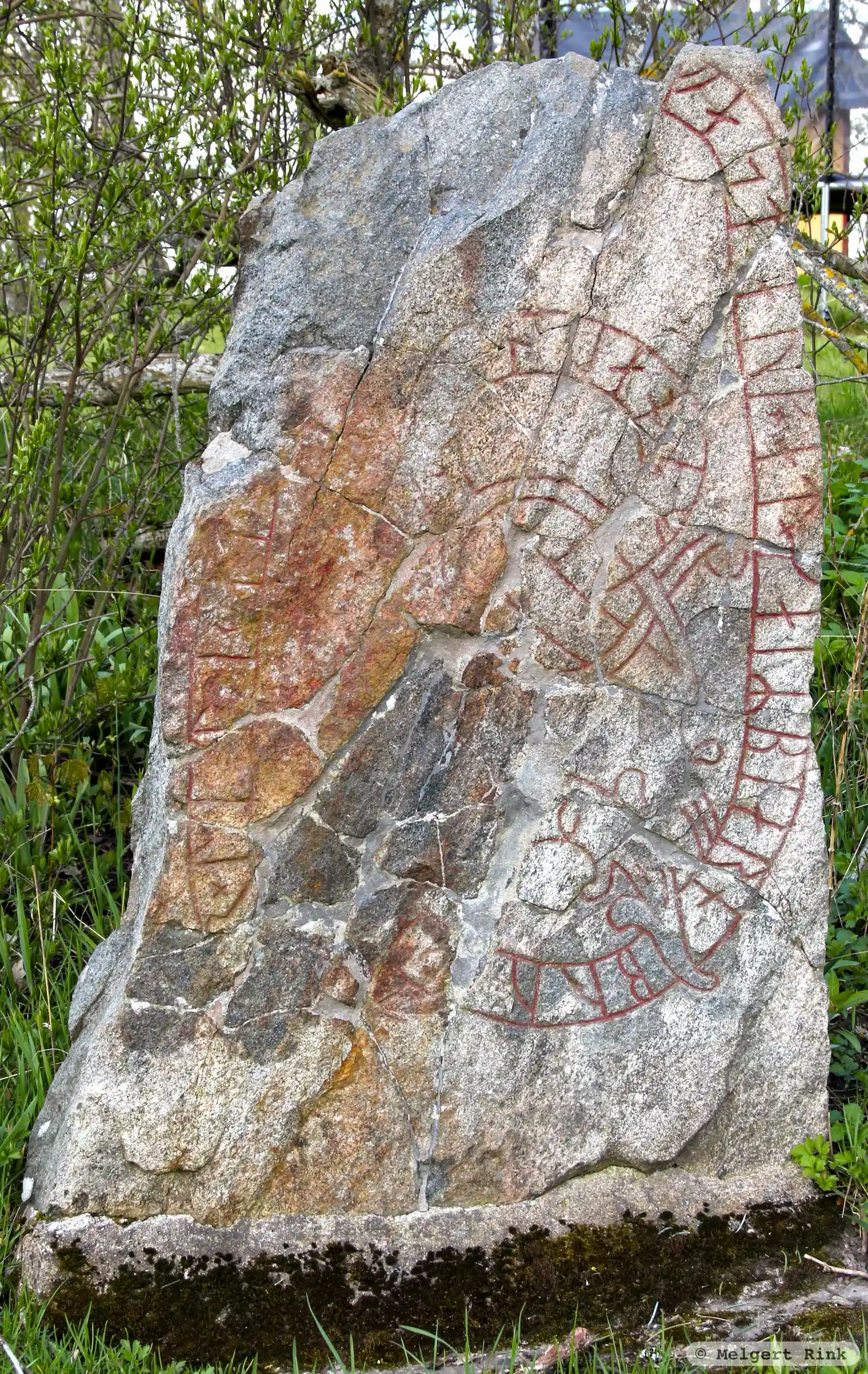
Photo: Melgert Rink
Runic inscription
[þ(o)]...r × lit × rai... ... ...fast · auk × at × (k)aiRbiarn × bruþ- ... ...i(R) · (t)o a(u)s... ×
Inscription
[þ(o)]...r × lit × rai... ... ...fast · auk × at × (k)aiRbiarn × bruþ- ... ...i(R) · (t)o a(u)s... ×
Translation
... had raised ... ...-fastr and in memory of Geirbjôrn, (their) brothers ... They died in the east.
Find the carving
Rune-stone U154, L2014:682 in Täby parish, Täby municipality
Facts
| Monument number | L2014:682 |
|---|---|
| Swedish National Heritage Board ID | Täby 74:3 |
| Status | Confirmed on location |
| Place | Visible above ground |
| Period | Viking age |
| Antiquarian assessment | Ancient monument |
| Damage status | Unknown |
| County | Stockholm |
| Municipality | Täby |
| Parish | Täby |
| Coordinates | 59.4738935, 18.0208265 |
Sources
Most of the factual information in Runkartan comes from the Swedish National Heritage Board’s Fornsök data and from the Scandinavian Runic Text Database. The maps come from OpenStreetMap and Leaflet.js. The photographs were taken by the credited photographers.