Rune-stone U135, L2015:9700 in Täby parish, Täby municipality
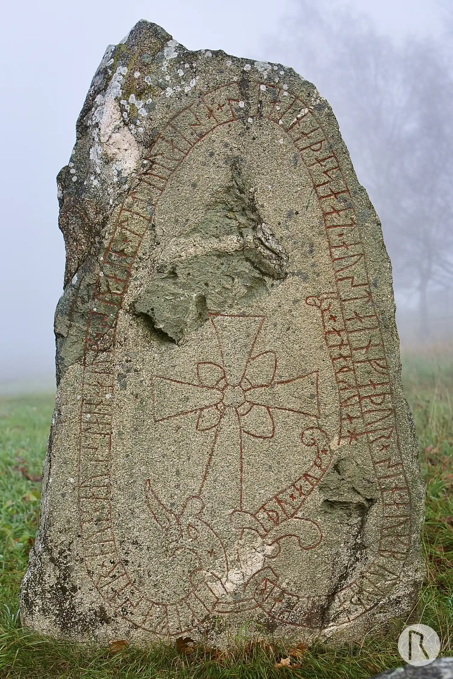
Photo: Niklas Vackerdag
Runic inscription
× ikifastr × auk × austain × auk × suain × litu · raisa + staina þasa · at · austain faþur × sin × auk × bru × þasa karþu × auk × hauk þana ×
Inscription
× ikifastr × auk × austain × auk × suain × litu · raisa + staina þasa · at · austain faþur × sin × auk × bru × þasa karþu × auk × hauk þana ×
Translation
Ingifastr and Eysteinn and Sveinn had these stones raised in memory of Eysteinn, their father, and made this bridge and this mound.
Find the carving
Rune-stone U135, L2015:9700 in Täby parish, Täby municipality
Facts
| Monument number | L2015:9700 |
|---|---|
| Swedish National Heritage Board ID | Täby 42:4 |
| Carver | Samma som gjort U 136. |
| Status | Confirmed on location |
| Place | Visible above ground |
| Material | Granite |
| Period | Viking age |
| Antiquarian assessment | Ancient monument |
| Damage status | Unknown |
| County | Stockholm |
| Municipality | Täby |
| Parish | Täby |
| Coordinates | 59.481825, 18.043235 |
Sources
Most of the factual information in Runkartan comes from the Swedish National Heritage Board’s Fornsök data and from the Scandinavian Runic Text Database. The maps come from OpenStreetMap and Leaflet.js. The photographs were taken by the credited photographers.