Rune-stone U1174, L1944:754 in Vittinge parish, Heby municipality
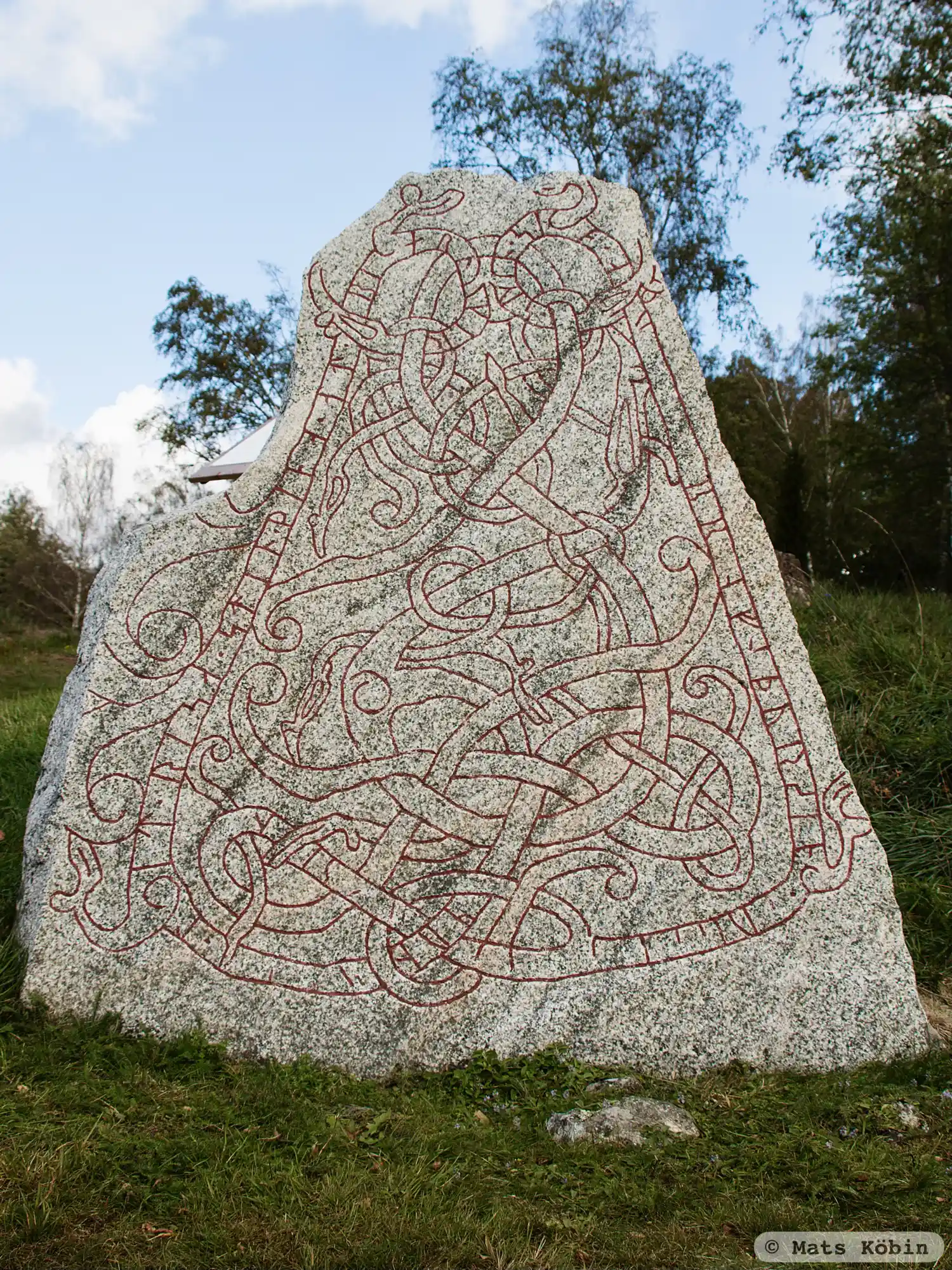
Photo: Mats Köbin
Runic inscription
(m)unul-- · lit · risa · stin · þina · at · biarnkir ·: sun · sin · a(k) ...(b)rn faþur sin · -u--- -----sin · --
Inscription
(m)unul-- · lit · risa · stin · þina · at · biarnkir ·: sun · sin · a(k) ...(b)rn faþur sin · -u--- -----sin · --
Translation
Munulfr had this stone raised in memory of Bjarngeirr, his son, and ... his father ...
Find the carving
Rune-stone U1174, L1944:754 in Vittinge parish, Heby municipality
Facts
| Monument number | L1944:754 |
|---|---|
| Swedish National Heritage Board ID | Vittinge 17:1 |
| Carver | Ovan ristare. |
| Status | Confirmed on location |
| Place | Visible above ground |
| Material | Granite |
| Period | Viking age |
| Antiquarian assessment | Ancient monument |
| Damage status | Damage |
| County | Uppsala |
| Municipality | Heby |
| Parish | Vittinge |
| Coordinates | 59.9291395, 16.977813 |
Sources
Most of the factual information in Runkartan comes from the Swedish National Heritage Board’s Fornsök data and from the Scandinavian Runic Text Database. The maps come from OpenStreetMap and Leaflet.js. The photographs were taken by the credited photographers.