Rune-stone U1146, L1941:1439 in Tolfta parish, Tierp municipality
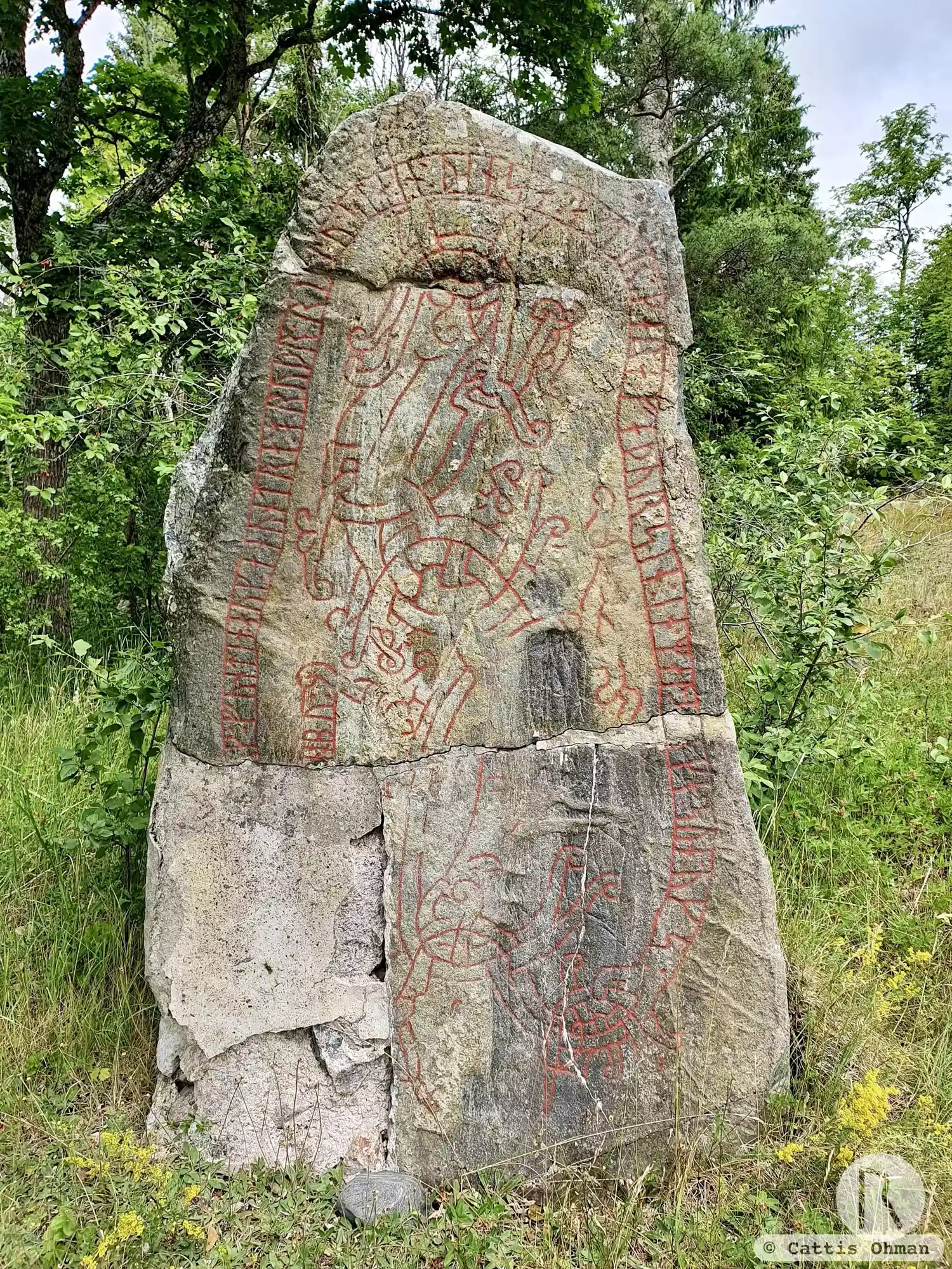
Photo: Cattis Öhman
Runic inscription
[raþulfr : (a)](u)k : funtin : auk : a(n)untra : bruþr : ritu : stain : þinsa : abtir : kara : faþur : sin : in : mal:s[b]aka : sun : uks : [i · sua]n[o]bu :
Inscription
[raþulfr : (a)](u)k : funtin : auk : a(n)untra : bruþr : ritu : stain : þinsa : abtir : kara : faþur : sin : in : mal:s[b]aka : sun : uks : [i · sua]n[o]bu :
Translation
Ráðulfr and Fundinn and Ônundr, the brothers erected this stone in memory of Kári the Eloquent, their father, the son of Uggr of Svanabýr.
Find the carving
Rune-stone U1146, L1941:1439 in Tolfta parish, Tierp municipality
Facts
| Monument number | L1941:1439 |
|---|---|
| Swedish National Heritage Board ID | Tolfta 8:1 |
| Carver | Samma som gjort U 1016. |
| Status | Confirmed on location |
| Place | Visible above ground |
| Material | Dark diabase |
| Period | Viking age |
| Antiquarian assessment | Ancient monument |
| Damage status | Undamaged |
| County | Uppsala |
| Municipality | Tierp |
| Parish | Tolfta |
| Coordinates | 60.350664, 17.544781 |
Sources
Most of the factual information in Runkartan comes from the Swedish National Heritage Board’s Fornsök data and from the Scandinavian Runic Text Database. The maps come from OpenStreetMap and Leaflet.js. The photographs were taken by the credited photographers.