Rune-stone U1048, L1944:6238 in Björklinge parish, Uppsala municipality
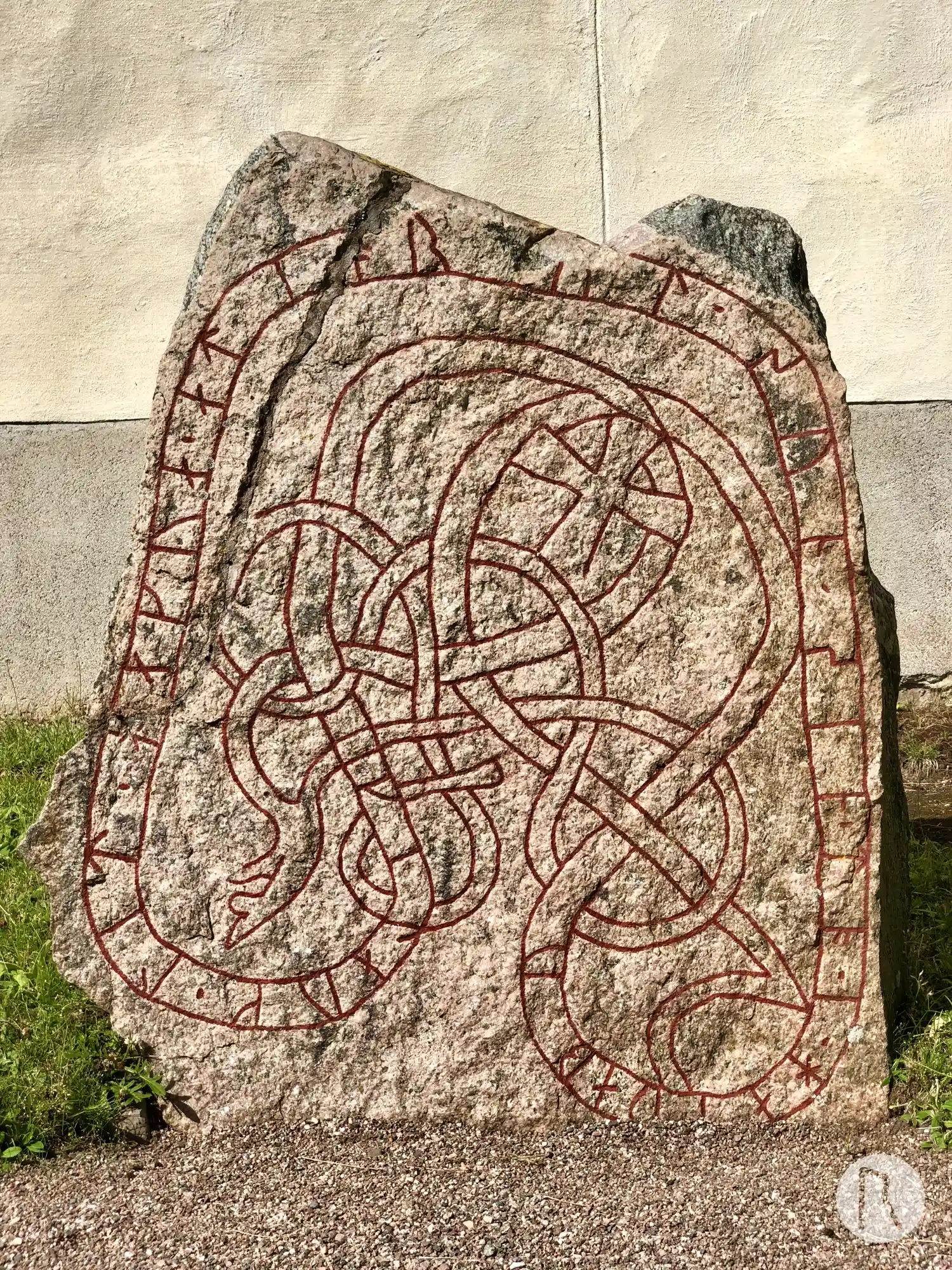
Photo: Niklas Vackerdag
Runic inscription
kilauk ' lit ' hakua ' at ' i(o)rut · sun sin ' (t)o ' i haiþaby
Inscription
kilauk ' lit ' hakua ' at ' i(o)rut · sun sin ' (t)o ' i haiþaby
Translation
Gillaug had (the stone) cut in memory of Jôrundr, her son. (He) died in Hedeby.
Find the carving
Rune-stone U1048, L1944:6238 in Björklinge parish, Uppsala municipality
Facts
| Monument number | L1944:6238 |
|---|---|
| Swedish National Heritage Board ID | Björklinge 25:1 |
| Carver | Samma som gjort U 1050 och 1060 |
| Status | Confirmed on location |
| Place | Visible above ground |
| Material | Dark granite with lightred surface |
| Period | Viking age |
| Antiquarian assessment | Ancient monument |
| Damage status | Damage |
| County | Uppsala |
| Municipality | Uppsala |
| Parish | Björklinge |
| Coordinates | 60.026861, 17.552792 |
Sources
Most of the factual information in Runkartan comes from the Swedish National Heritage Board’s Fornsök data and from the Scandinavian Runic Text Database. The maps come from OpenStreetMap and Leaflet.js. The photographs were taken by the credited photographers.