Rune-stone U1012, L1942:737 in Rasbokil parish, Uppsala municipality
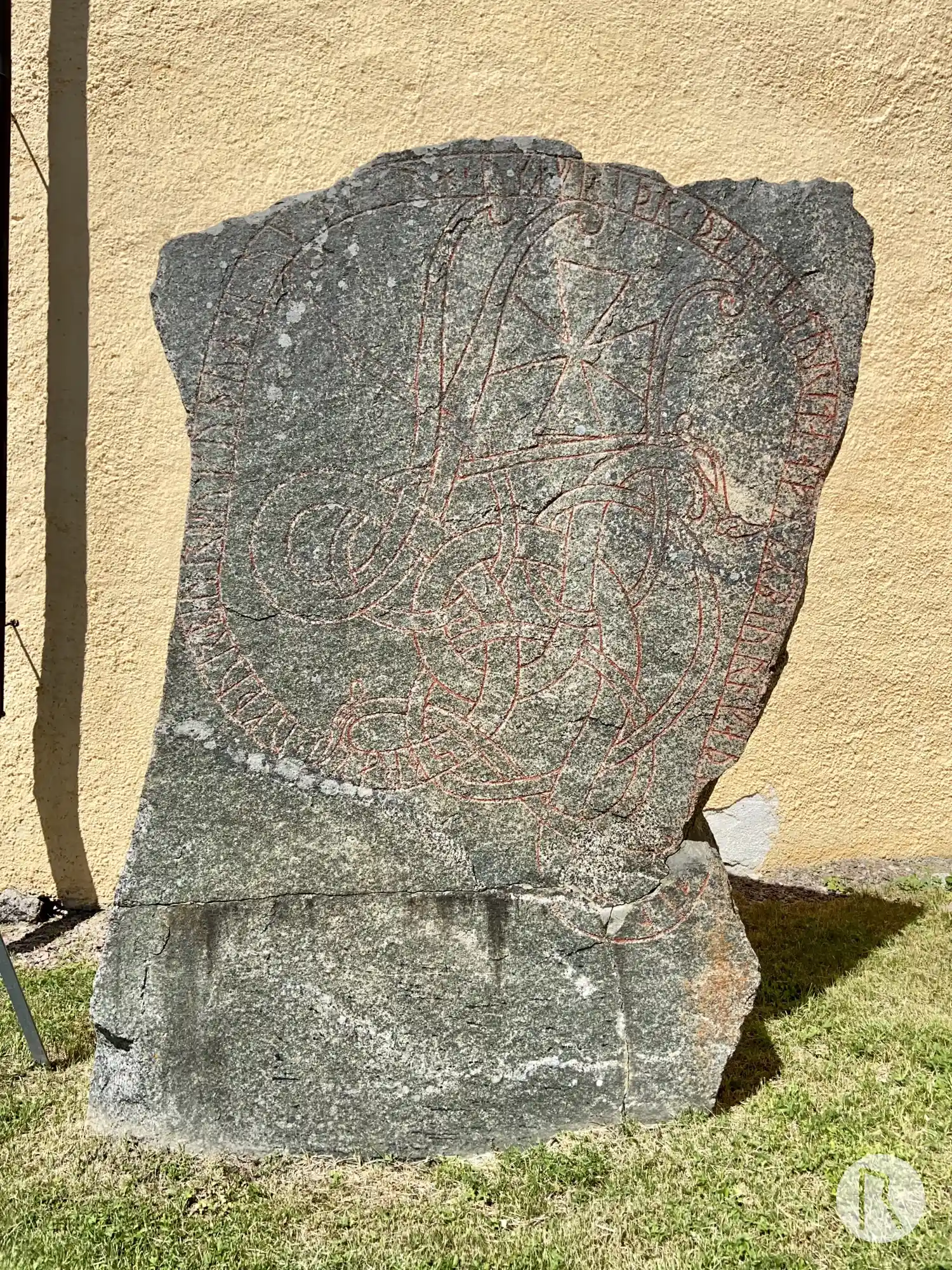
Photo: Niklas Vackerdag
Runic inscription
sbraki ' uk þur'biurn ' uk uþuhin ' uk| |kinlauh ' uk (a)friþr ' þaun litu rita ' aftiR biurn faþ(u)- (s)in
Inscription
sbraki ' uk þur'biurn ' uk uþuhin ' uk| |kinlauh ' uk (a)friþr ' þaun litu rita ' aftiR biurn faþ(u)- (s)in
Translation
Spraki and Þorbjôrn and Óþveginn and Ginnlaug and Áfríðr(?), they had (this) erected in memory of Bjôrn, their father.
Find the carving
Rune-stone U1012, L1942:737 in Rasbokil parish, Uppsala municipality
Facts
| Monument number | L1942:737 |
|---|---|
| Swedish National Heritage Board ID | Rasbokil 1:1 |
| Carver | Åsmund (A) |
| Status | Confirmed on location |
| Place | Visible above ground |
| Material | Light coarse-grained granite |
| Period | Viking age |
| Antiquarian assessment | Ancient monument |
| Damage status | Unknown |
| County | Uppsala |
| Municipality | Uppsala |
| Parish | Rasbokil |
| Coordinates | 59.992745, 17.860237 |
Sources
Most of the factual information in Runkartan comes from the Swedish National Heritage Board’s Fornsök data and from the Scandinavian Runic Text Database. The maps come from OpenStreetMap and Leaflet.js. The photographs were taken by the credited photographers.