Rune-stone Sö344, L2015:4333 in Södertälje parish, Södertälje municipality
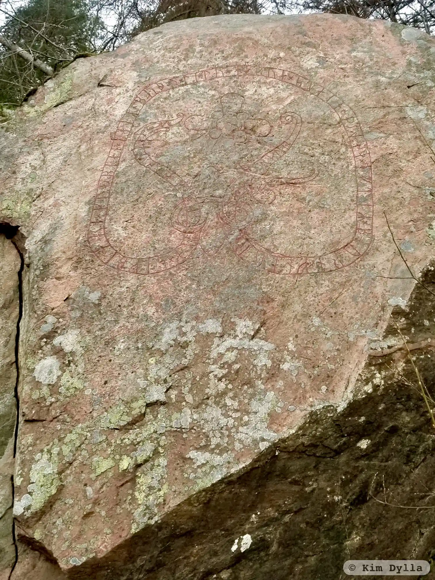
Photo: Kim Dylla
Runic inscription
× auþbiarn × auk × sigbiarn × kuþbian × þaiR × byþr × litu × hakua × stain × þinsa × eftiR × biurn × fnþur × sin ...(y)stain
Inscription
× auþbiarn × auk × sigbiarn × kuþbian × þaiR × byþr × litu × hakua × stain × þinsa × eftiR × biurn × fnþur × sin ...(y)stain
Translation
Auðbjôrn and Sigbjôrn and Guðbjôrn, those brothers had this stone cut in memory of Bjôrn, their father. Eysteinn.
Find the carving
Rune-stone Sö344, L2015:4333 in Södertälje parish, Södertälje municipality
Facts
| Monument number | L2015:4333 |
|---|---|
| Swedish National Heritage Board ID | Södertälje 22:1 |
| Carver | Östen 1 (S) |
| Status | Confirmed on location |
| Place | Visible above ground |
| Period | Viking age |
| Antiquarian assessment | Ancient monument |
| Damage status | Unknown |
| County | Stockholm |
| Municipality | Södertälje |
| Parish | Södertälje |
| Coordinates | 59.2382085, 17.5949725 |
Sources
Most of the factual information in Runkartan comes from the Swedish National Heritage Board’s Fornsök data and from the Scandinavian Runic Text Database. The maps come from OpenStreetMap and Leaflet.js. The photographs were taken by the credited photographers.