Rune-stone Sö335, L1983:7518 in Åker parish, Strängnäs municipality
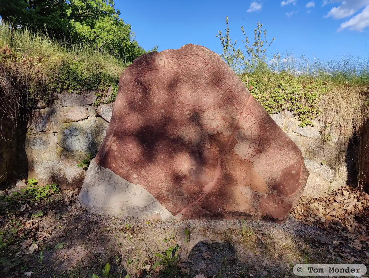
Photo: Tom Monder
Runic inscription
uulf^ui : raisti : stain þana| |at bruþur sin : u:snikin saR furs : a:ust:arla : maþ : i:ikn:u:ari : ksibari hulmstains
Inscription
uulf^ui : raisti : stain þana| |at bruþur sin : u:snikin saR furs : a:ust:arla : maþ : i:ikn:u:ari : ksibari hulmstains
Translation
Ulfr(?) raised this stone in memory of his brother Ósníkinn. He perished in the east with Ingvarr; (he was) Holmsteinn's seaman.
Find the carving
Rune-stone Sö335, L1983:7518 in Åker parish, Strängnäs municipality
Facts
| Monument number | L1983:7518 |
|---|---|
| Swedish National Heritage Board ID | Åker 137:1 |
| Status | Confirmed on location |
| Place | Visible above ground |
| Material | Sandstone |
| Period | Viking age |
| Antiquarian assessment | Ancient monument |
| Damage status | Undamaged |
| County | Södermanland |
| Municipality | Strängnäs |
| Parish | Åker |
| Coordinates | 59.273836, 17.1317175 |
Sources
Most of the factual information in Runkartan comes from the Swedish National Heritage Board’s Fornsök data and from the Scandinavian Runic Text Database. The maps come from OpenStreetMap and Leaflet.js. The photographs were taken by the credited photographers.