Rune-stone Sö22, L2016:7138 in Mörkö parish, Södertälje municipality
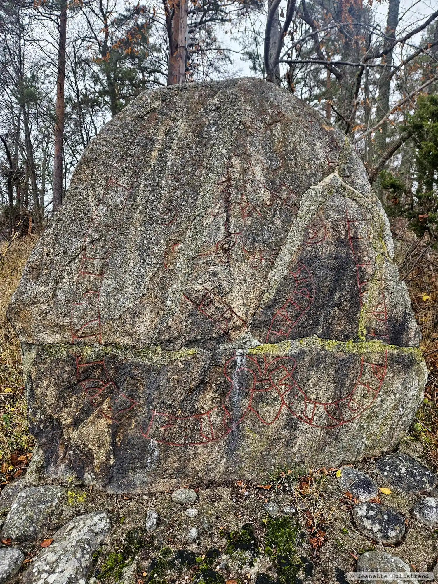
Photo: Jeanette Hultstrand
Runic inscription
· þr-skr : auk : f(r)usti : litu : k(a)r[a] (:) (b)[ro : a]uk · (l)itu : raisa : s(t)(i)[n] : at : orma : faþur : s[i]n : koþan
Inscription
· þr-skr : auk : f(r)usti : litu : k(a)r[a] (:) (b)[ro : a]uk · (l)itu : raisa : s(t)(i)[n] : at : orma : faþur : s[i]n : koþan
Translation
Þrjózkr and Frosti had the bridge made and had the stone raised in memory of Ormi, their good father.
Find the carving
Rune-stone Sö22, L2016:7138 in Mörkö parish, Södertälje municipality
Facts
| Monument number | L2016:7138 |
|---|---|
| Swedish National Heritage Board ID | Mörkö 67:1 |
| Status | Confirmed on location |
| Place | Visible above ground |
| Material | Granitee |
| Antiquarian assessment | Ancient monument |
| Damage status | Unknown |
| County | Stockholm |
| Municipality | Södertälje |
| Parish | Mörkö |
| Coordinates | 58.9983865, 17.6643385 |
Sources
Most of the factual information in Runkartan comes from the Swedish National Heritage Board’s Fornsök data and from the Scandinavian Runic Text Database. The maps come from OpenStreetMap and Leaflet.js. The photographs were taken by the credited photographers.