Rune-stone Sm131, L1974:6548 in Flisby parish, Nässjö municipality
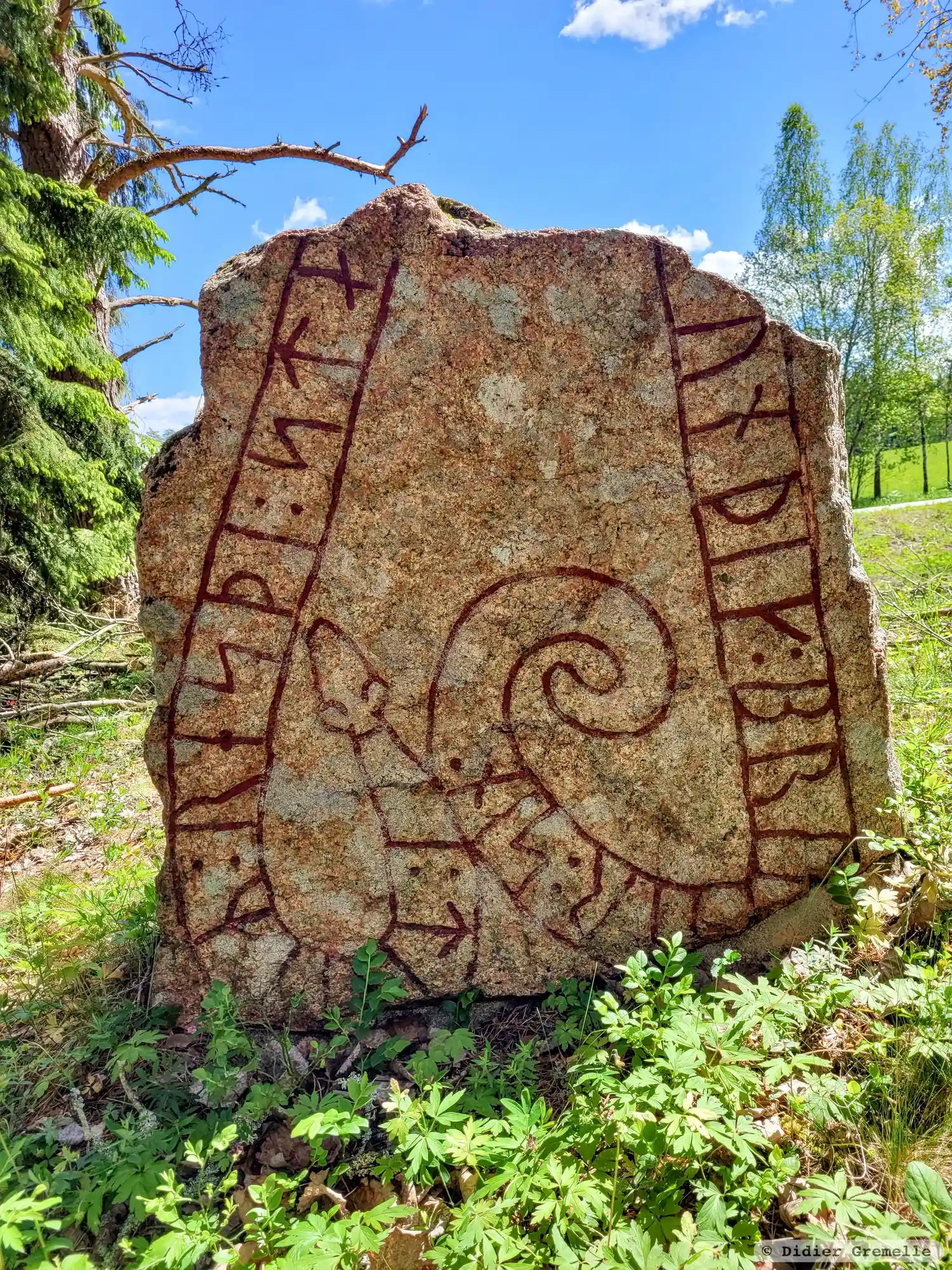
Photo: Didier Gremelle
Runic inscription
: tu-iR : resþi : sta... ... unþik : bru-ur : sin :
Inscription
: tu-iR : resþi : sta... ... unþik : bru-ur : sin :
Translation
Tólir/Dóttir raised the stone ... Óníðingr, his/her brother.
Find the carving
Rune-stone Sm131, L1974:6548 in Flisby parish, Nässjö municipality
Facts
| Monument number | L1974:6548 |
|---|---|
| Swedish National Heritage Board ID | Flisby 21:1 |
| Status | Confirmed on location |
| Place | Visible above ground |
| Material | Red medium-grained granite |
| Antiquarian assessment | Ancient monument |
| Damage status | Damage |
| County | Jönköping |
| Municipality | Nässjö |
| Parish | Flisby |
| Coordinates | 57.7633365, 14.8070185 |
Sources
Most of the factual information in Runkartan comes from the Swedish National Heritage Board’s Fornsök data and from the Scandinavian Runic Text Database. The maps come from OpenStreetMap and Leaflet.js. The photographs were taken by the credited photographers.