Rune-stone Slakastenen, Ög117, L2010:2957 in Slaka parish, Linköping municipality
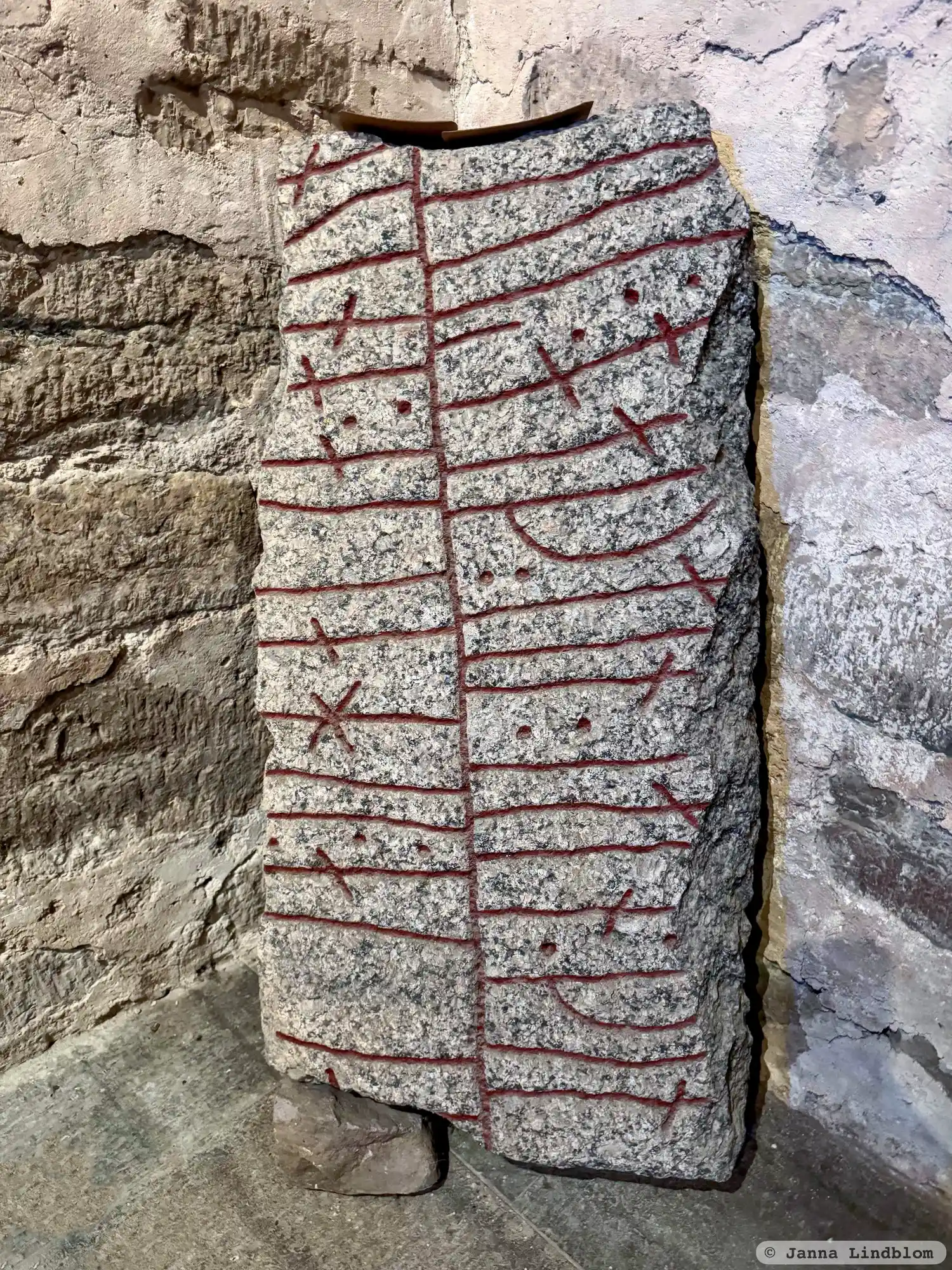
Photo: Janna Lindblom
Runic inscription
...uiR ÷ baþ [÷] t[io ÷ stin ÷] (þ)(i)(n)... ...---a ÷ --h(a)--- : --(u)-...
Inscription
...uiR ÷ baþ [÷] t[io ÷ stin ÷] (þ)(i)(n)... ...---a ÷ --h(a)--- : --(u)-...
Translation
...-vér ordered this stone be fashioned ...
Find the carving
Rune-stone Slakastenen, Ög117, L2010:2957 in Slaka parish, Linköping municipality
Facts
| Monument number | L2010:2957 |
|---|---|
| Swedish National Heritage Board ID | Slaka 52:3 |
| Status | Confirmed on location |
| Place | Visible above ground |
| Material | Granite |
| Antiquarian assessment | Ancient monument |
| Damage status | Damage |
| County | Östergötland |
| Municipality | Linköping |
| Parish | Slaka |
| Coordinates | 58.3712405, 15.5557275 |
Sources
Most of the factual information in Runkartan comes from the Swedish National Heritage Board’s Fornsök data and from the Scandinavian Runic Text Database. The maps come from OpenStreetMap and Leaflet.js. The photographs were taken by the credited photographers.