Rune-stone Örnsbacken, U319, L2016:9477 in Skånela parish, Sigtuna municipality
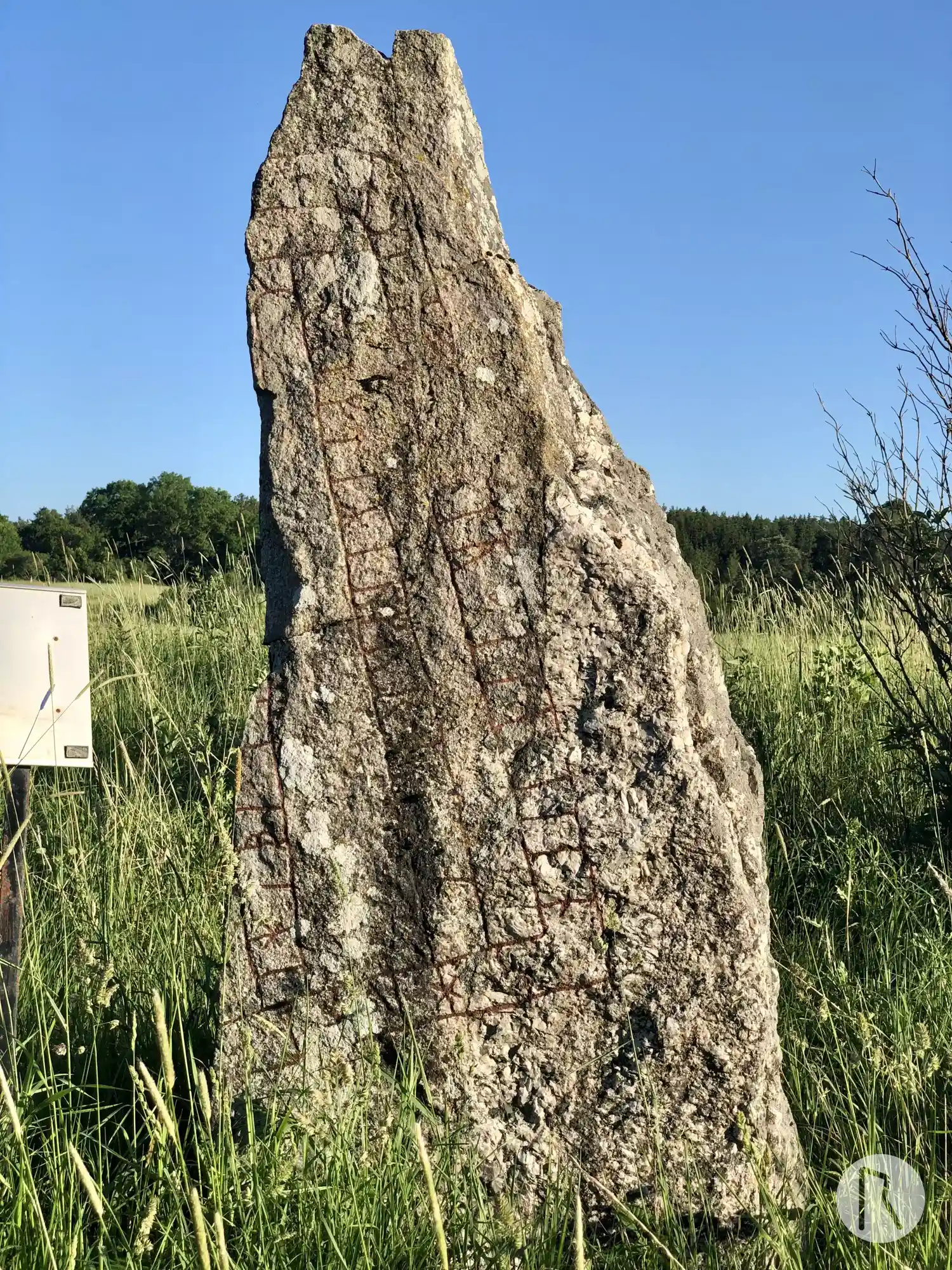
Photo: Niklas Vackerdag
Runic inscription
[kitilui · auk · kiau þau · risþi · stin] · þinsi · if[tiR] · iusti[n · -- ·] n[-]...hunt ihlbi · (k)[uþ · aon · hiti u]isa iftiR · iufur · i[arþn]n
Inscription
[kitilui · auk · kiau þau · risþi · stin] · þinsi · if[tiR] · iusti[n · -- ·] n[-]...hunt ihlbi · (k)[uþ · aon · hiti u]isa iftiR · iufur · i[arþn]n
Translation
Ketilvé and Ketill(?), they raised this stone in memory of Jósteinn ... May God help ... raise(?) in memory of Jôfurr ...
Find the carving
Rune-stone Örnsbacken, U319, L2016:9477 in Skånela parish, Sigtuna municipality
Facts
| Monument number | L2016:9477 |
|---|---|
| Swedish National Heritage Board ID | Skånela 163:2 |
| Carver | Gunnar (A) |
| Status | Confirmed on location |
| Place | Visible above ground |
| Material | Granite |
| Antiquarian assessment | Ancient monument |
| Damage status | Unknown |
| County | Stockholm |
| Municipality | Sigtuna |
| Parish | Skånela |
| Coordinates | 59.609703, 17.99315 |
Sources
Most of the factual information in Runkartan comes from the Swedish National Heritage Board’s Fornsök data and from the Scandinavian Runic Text Database. The maps come from OpenStreetMap and Leaflet.js. The photographs were taken by the credited photographers.