Rune-stone ÖlATA4703/43, L1957:1311 in Köping parish, Köping municipality
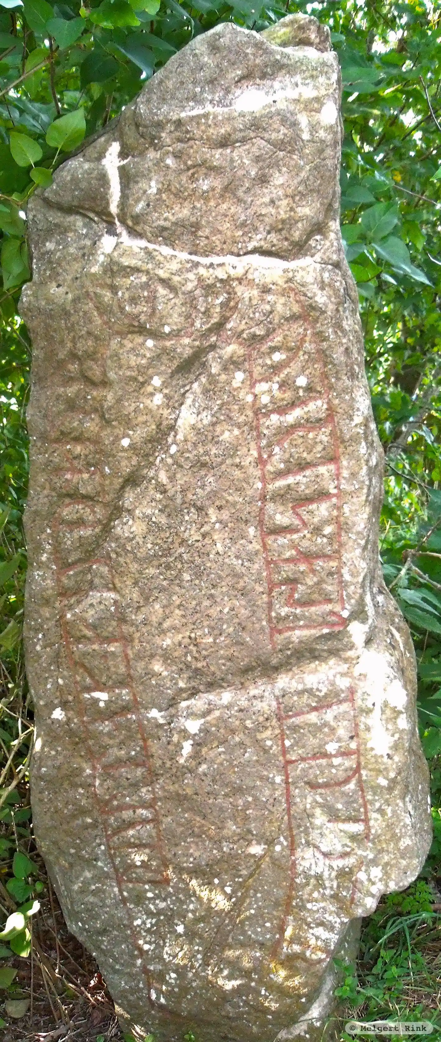
Photo: Melgert Rink
Runic inscription
§P ... --k kuþ---r · li-u · resa st-- þ--- r... §Q þurlak ¶ ...(u)k ¶ kuþmuþr litu risa st... ... (þ)(u)rbia...
Inscription
§P ... --k kuþ---r · li-u · resa st-- þ--- r... §Q þurlak ¶ ...(u)k ¶ kuþmuþr litu risa st... ... (þ)(u)rbia...
Translation
§P ... and Guð-... had this stone raised ... §Q Þorlakr and Guðmóðr had the stone raised in memory of Þorbjôrn.
Find the carving
Rune-stone ÖlATA4703/43, L1957:1311 in Köping parish, Köping municipality
Facts
| Monument number | L1957:1311 |
|---|---|
| Swedish National Heritage Board ID | Köping 40:1 |
| Status | Confirmed on location |
| Place | Visible above ground |
| Material | Light red sandstone |
| Antiquarian assessment | Ancient monument |
| Damage status | Damage |
| County | Västmanland |
| Municipality | Köping |
| Parish | Köping |
| Coordinates | 56.8779765, 16.7109765 |
Sources
Most of the factual information in Runkartan comes from the Swedish National Heritage Board’s Fornsök data and from the Scandinavian Runic Text Database. The maps come from OpenStreetMap and Leaflet.js. The photographs were taken by the credited photographers.