Rune-stone ÖgFv1970;310, L2011:3168 in Kullerstad parish, Norrköping municipality
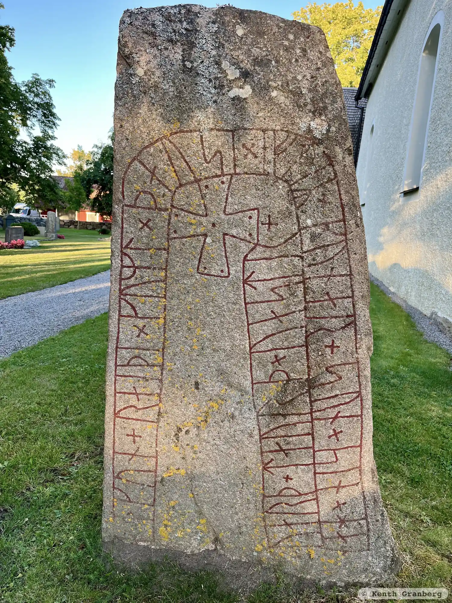
Photo: Kenth Granberg
Runic inscription
hakun + raiþi × kuml × þausi × eftiR × kunar + sun × sin × han × uarþ × taurþ × uastr +
Inscription
hakun + raiþi × kuml × þausi × eftiR × kunar + sun × sin × han × uarþ × taurþ × uastr +
Translation
Hákon raised these monuments in memory of Gunnarr, his son. He died in the west.
Find the carving
Rune-stone ÖgFv1970;310, L2011:3168 in Kullerstad parish, Norrköping municipality
Facts
| Monument number | L2011:3168 |
|---|---|
| Swedish National Heritage Board ID | Kullerstad 69:1 |
| Status | Confirmed on location |
| Place | Visible above ground |
| Material | Granite |
| Antiquarian assessment | Ancient monument |
| Damage status | Undamaged |
| County | Östergötland |
| Municipality | Norrköping |
| Parish | Kullerstad |
| Coordinates | 58.5803755, 15.9434015 |
Sources
Most of the factual information in Runkartan comes from the Swedish National Heritage Board’s Fornsök data and from the Scandinavian Runic Text Database. The maps come from OpenStreetMap and Leaflet.js. The photographs were taken by the credited photographers.