Rune-stone ÖgFv1966;102, L2010:3234 in Söderköping parish, Söderköping municipality
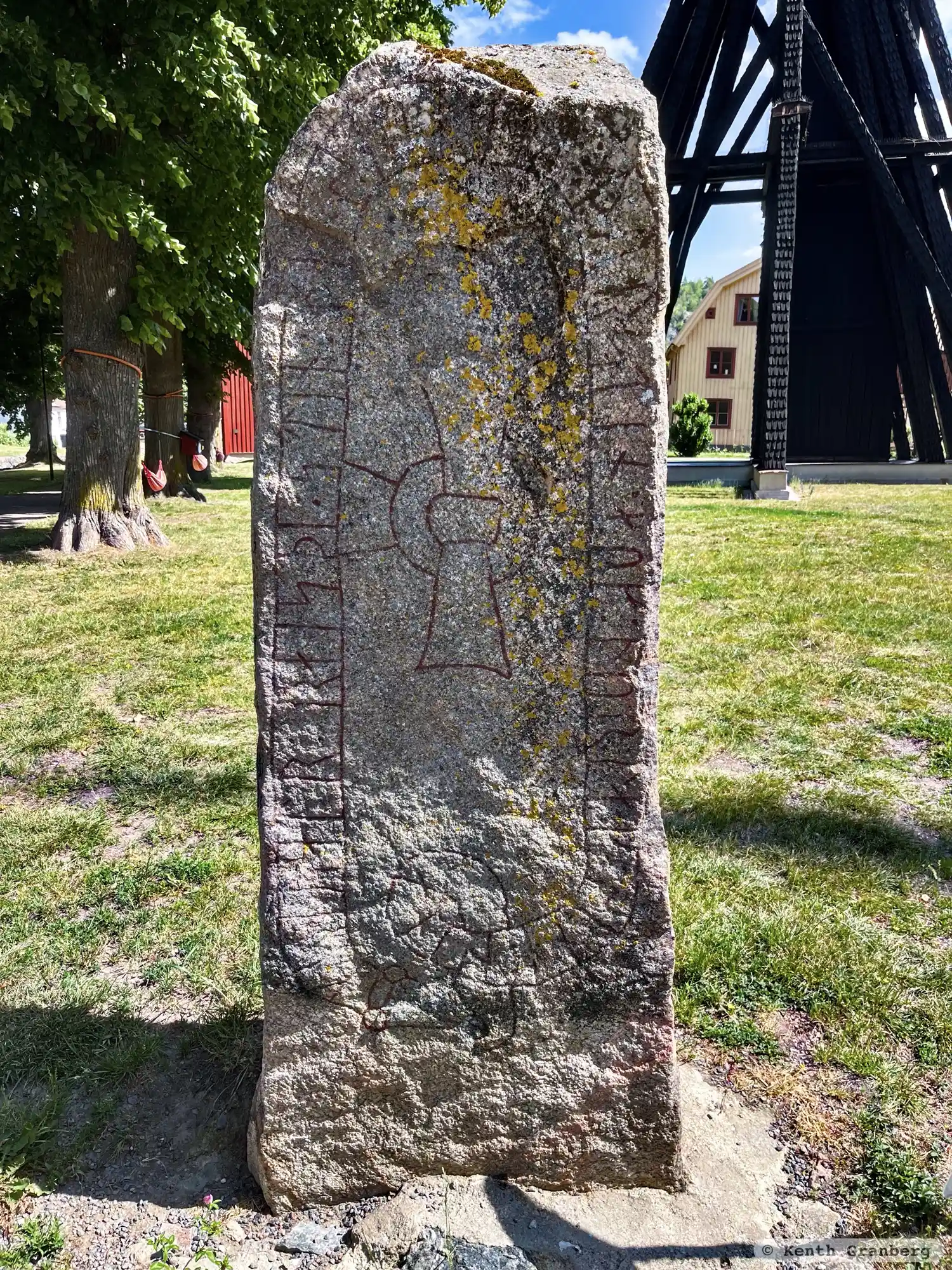
Photo: Kenth Granberg
Runic inscription
kunuatr : raisþi : stin : þansi : eftiR : þurstin : auk : þurlak : suni : sina
Inscription
kunuatr : raisþi : stin : þansi : eftiR : þurstin : auk : þurlak : suni : sina
Translation
Gunnhvatr raised this stone in memory of Þorsteinn and Þorlakr, his sons.
Find the carving
Rune-stone ÖgFv1966;102, L2010:3234 in Söderköping parish, Söderköping municipality
Facts
| Monument number | L2010:3234 |
|---|---|
| Swedish National Heritage Board ID | Söderköping 7:1 |
| Status | Confirmed on location |
| Place | Visible above ground |
| Material | Granite |
| Antiquarian assessment | Ancient monument |
| Damage status | Damage |
| County | Östergötland |
| Municipality | Söderköping |
| Parish | Söderköping |
| Coordinates | 58.4804965, 16.3193605 |
Sources
Most of the factual information in Runkartan comes from the Swedish National Heritage Board’s Fornsök data and from the Scandinavian Runic Text Database. The maps come from OpenStreetMap and Leaflet.js. The photographs were taken by the credited photographers.