Rune-stone Ög172, L2011:6499 in Skärkind parish, Norrköping municipality
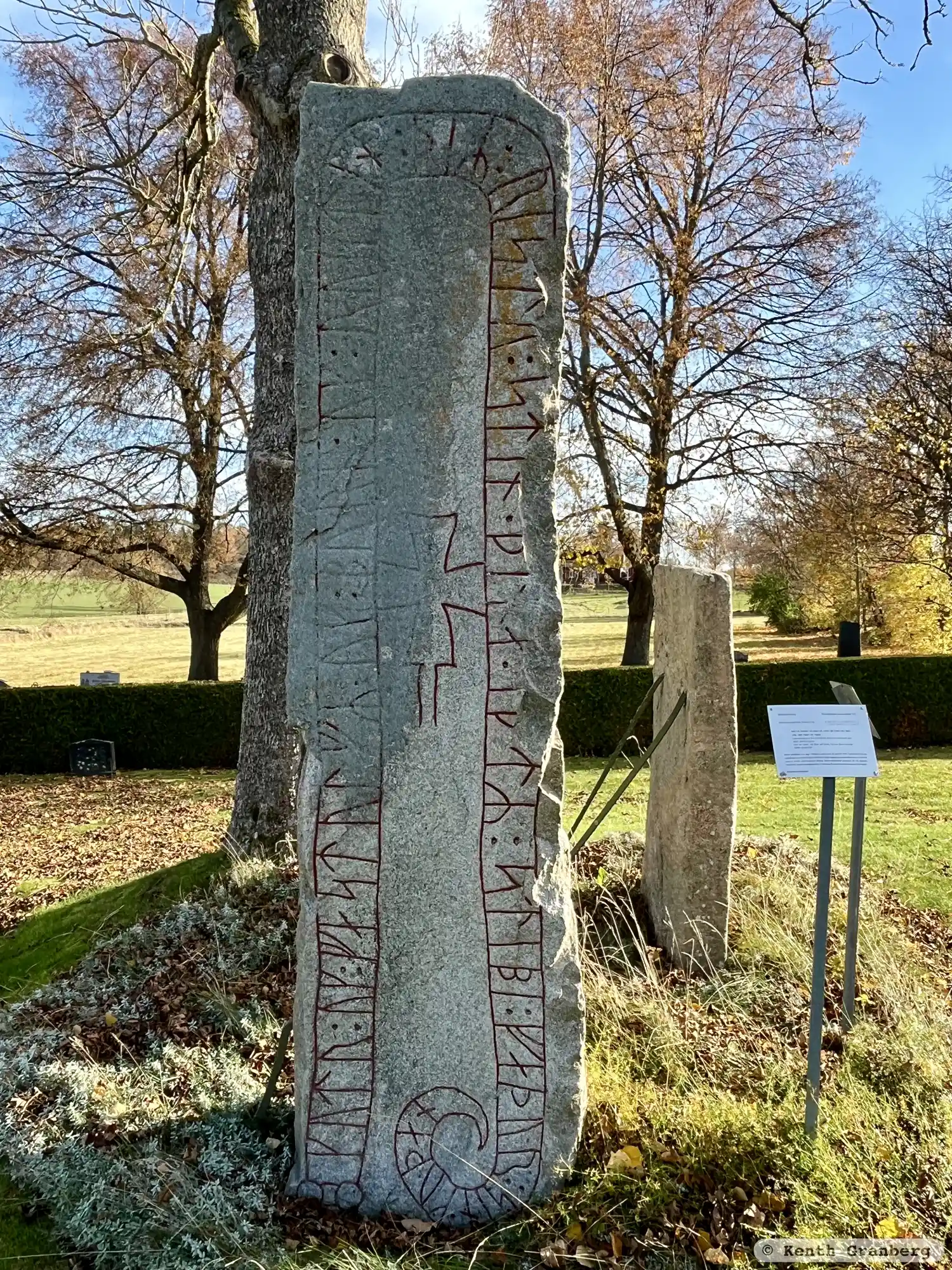
Photo: Kenth Granberg
Runic inscription
kutr : uk : fastulfR : uk : burn : uk : rustin : þiR : ristu : stin (:) þina (:) i-tR : stibi : faþur : sin · kuþan
Inscription
kutr : uk : fastulfR : uk : burn : uk : rustin : þiR : ristu : stin (:) þina (:) i-tR : stibi : faþur : sin · kuþan
Translation
Gautr and Fastulfr and Bjôrn and Hróðsteinn, they raised this stone in memory of Stybbir, their good father.
Find the carving
Rune-stone Ög172, L2011:6499 in Skärkind parish, Norrköping municipality
Facts
| Monument number | L2011:6499 |
|---|---|
| Swedish National Heritage Board ID | Skärkind 68:2 |
| Status | Confirmed on location |
| Place | Visible above ground |
| Material | Gray granite |
| Antiquarian assessment | Ancient monument |
| Damage status | Undamaged |
| County | Östergötland |
| Municipality | Norrköping |
| Parish | Skärkind |
| Coordinates | 58.4711785, 15.991059 |
Sources
Most of the factual information in Runkartan comes from the Swedish National Heritage Board’s Fornsök data and from the Scandinavian Runic Text Database. The maps come from OpenStreetMap and Leaflet.js. The photographs were taken by the credited photographers.