Rune-stone Ög146, L2012:4097 in Dagsberg parish, Norrköping municipality
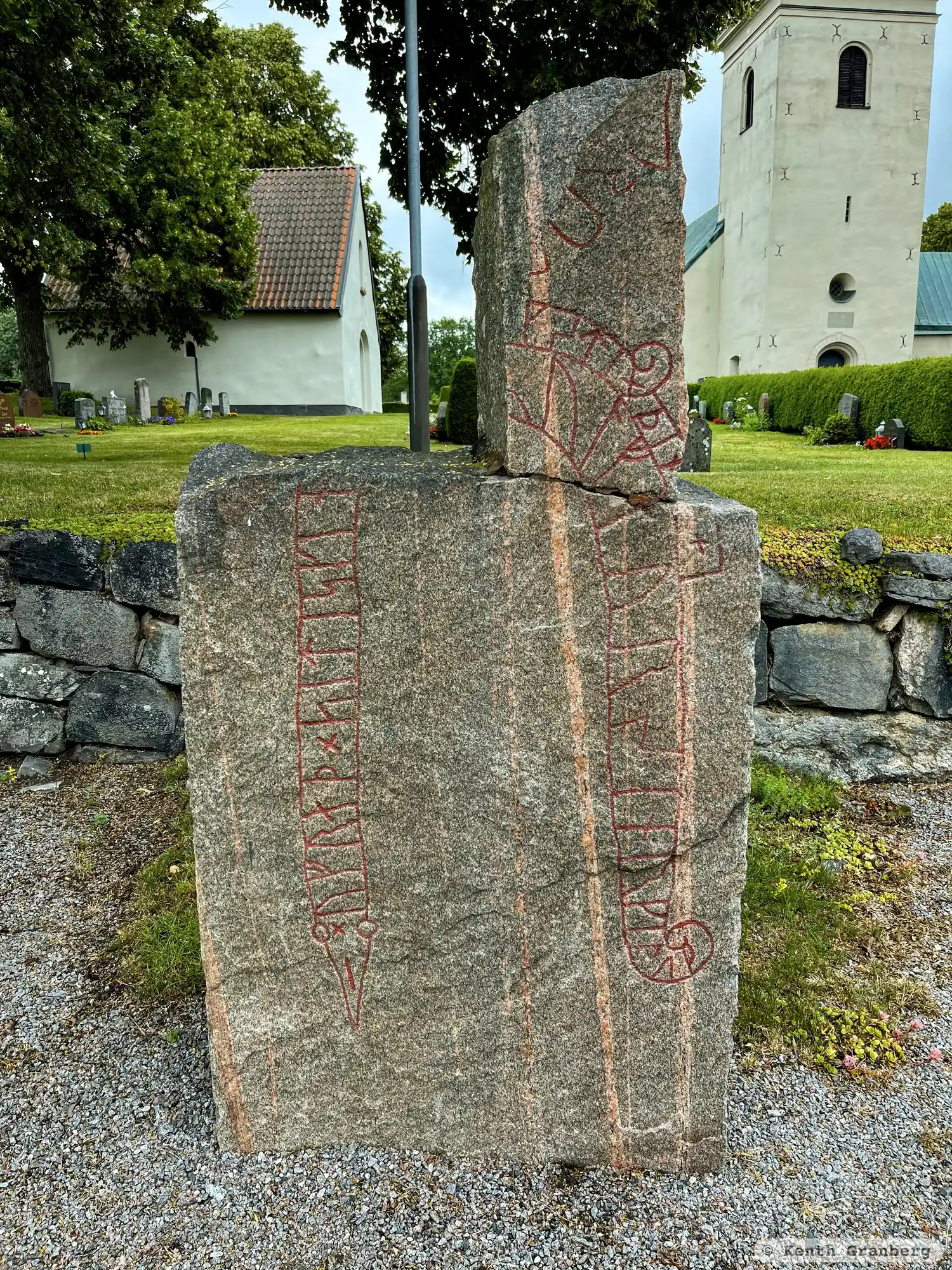
Photo: Kenth Granberg
Runic inscription
× ufraþ × siti skin ... (r)ulf (f)aur sin × rkil uk ... ...k stin þina +
Inscription
× ufraþ × siti skin ... (r)ulf (f)aur sin × rkil uk ... ...k stin þina +
Translation
Ofráðr placed the stone ... Hrólfr/-ulfr, his father. Arnkell and ... cut this stone.
Find the carving
Rune-stone Ög146, L2012:4097 in Dagsberg parish, Norrköping municipality
Facts
| Monument number | L2012:4097 |
|---|---|
| Swedish National Heritage Board ID | Dagsberg 5:1 |
| Status | Confirmed on location |
| Place | Visible above ground |
| Material | Reddish granite |
| Antiquarian assessment | Ancient monument |
| Damage status | Damage |
| County | Östergötland |
| Municipality | Norrköping |
| Parish | Dagsberg |
| Coordinates | 58.5822885, 16.3159665 |
Sources
Most of the factual information in Runkartan comes from the Swedish National Heritage Board’s Fornsök data and from the Scandinavian Runic Text Database. The maps come from OpenStreetMap and Leaflet.js. The photographs were taken by the credited photographers.