Rune-stone Hanstastenarna, U72, L2012:435 in Stockholm parish, Stockholm municipality
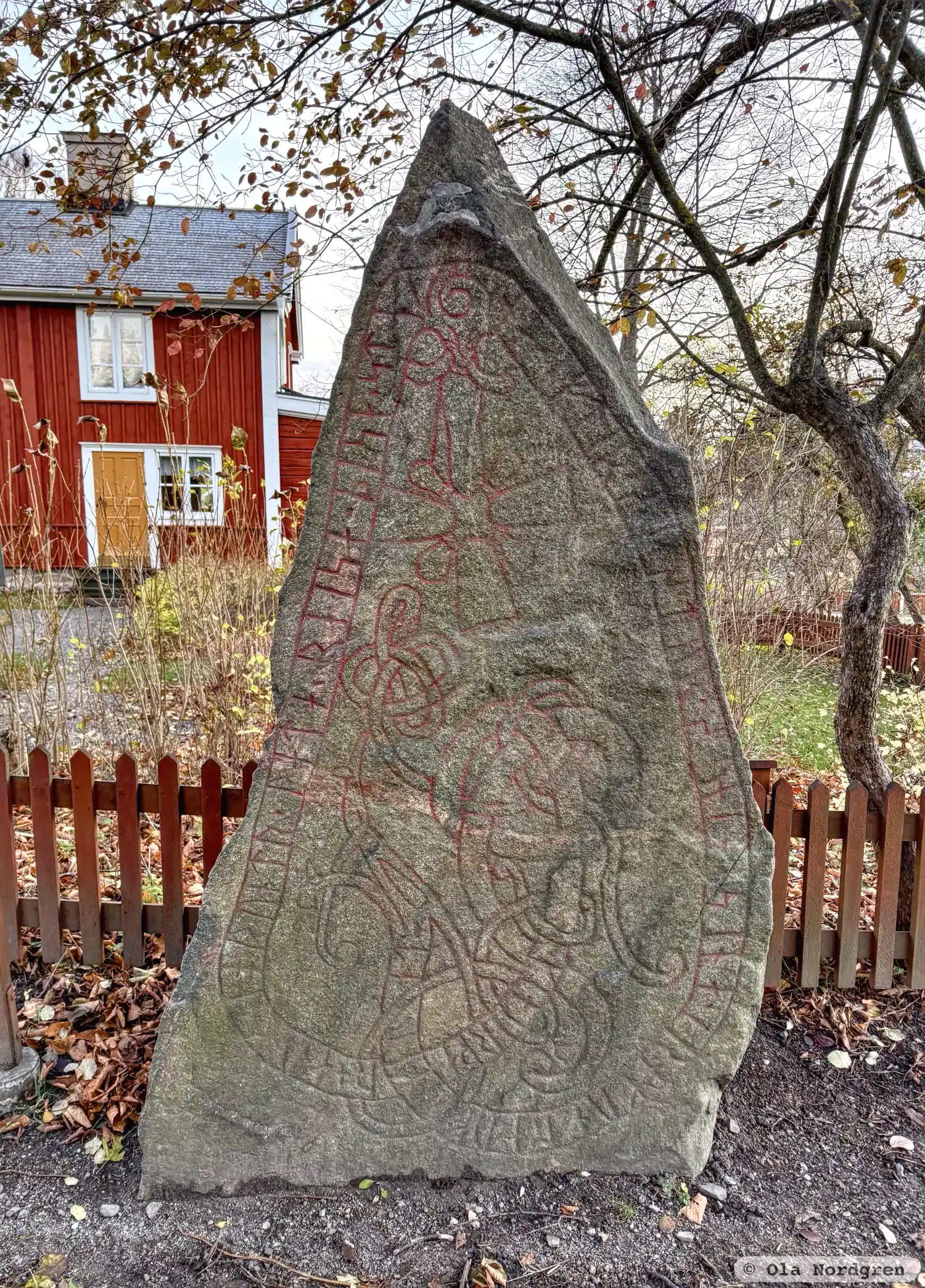
Photo: Ola Nordgren
Runic inscription
· kiarþar + auk · ioruntr · lata ' reisa · þisa · steina · eftir · systur·suni · sina · irnmunt : auk ' ikiunt ·
Inscription
· kiarþar + auk · ioruntr · lata ' reisa · þisa · steina · eftir · systur·suni · sina · irnmunt : auk ' ikiunt ·
Translation
Gerðarr and Jôrundr have raised these stones in memory of their sister's sons Ernmundr and Ingimundr.
Find the carving
Rune-stone Hanstastenarna, U72, L2012:435 in Stockholm parish, Stockholm municipality
Facts
| Monument number | L2012:435 |
|---|---|
| Swedish National Heritage Board ID | Stockholm 1193 |
| Carver | Visäte (A) |
| Status | Confirmed on location |
| Place | Visible above ground |
| Material | Granite |
| Period | Viking age |
| Antiquarian assessment | Ancient monument |
| Damage status | Undamaged |
| County | Stockholm |
| Municipality | Stockholm |
| Parish | Stockholm |
| Coordinates | 59.326684, 18.103131 |
Sources
Most of the factual information in Runkartan comes from the Swedish National Heritage Board’s Fornsök data and from the Scandinavian Runic Text Database. The maps come from OpenStreetMap and Leaflet.js. The photographs were taken by the credited photographers.