Rune-stone G373, L1976:6331 in Sproge parish, Gotland municipality
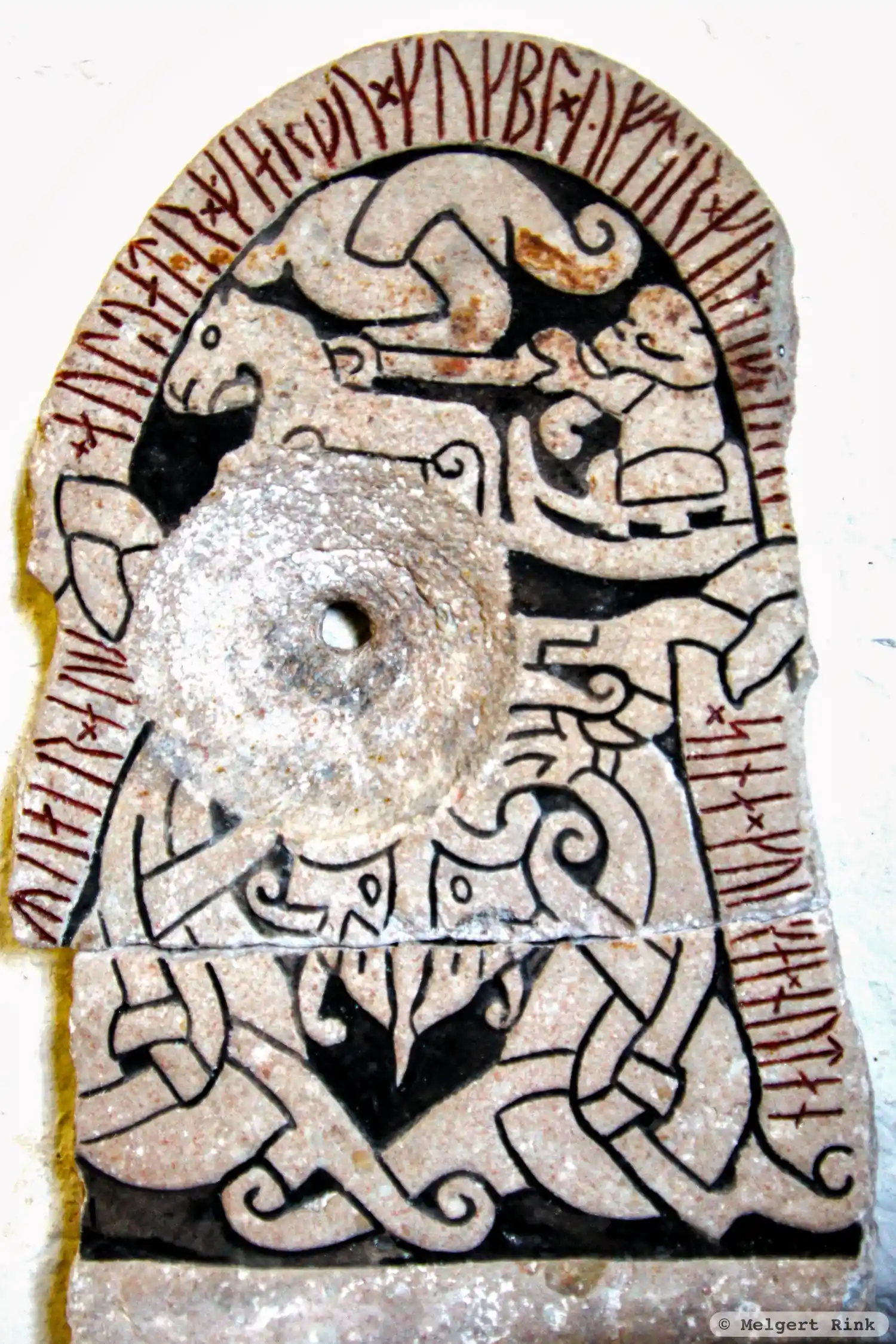
Photo: Melgert Rink
Runic inscription
...Rua-r × auk × auþuatr × giarþu × kukbl × yftir × kun(a)(i)þ(i) ----- × sina × ku--ai × nutan
Inscription
...Rua-r × auk × auþuatr × giarþu × kukbl × yftir × kun(a)(i)þ(i) ----- × sina × ku--ai × nutan
Translation
Geirhvatr(?) and Auðhvatr made the monument in memory of Gunnheiðr(?) ... their capable ...
Find the carving
Rune-stone G373, L1976:6331 in Sproge parish, Gotland municipality
Facts
| Monument number | L1976:6331 |
|---|---|
| Swedish National Heritage Board ID | Sproge 65:4 |
| Status | Confirmed on location |
| Place | Visible above ground |
| Material | Limestone with runic inscription |
| Period | Viking age |
| Antiquarian assessment | Other cultural-historical relic |
| Damage status | Unknown |
| County | Gotland |
| Municipality | Gotland |
| Parish | Sproge |
| Coordinates | 57.2536425, 18.2107815 |
Sources
Most of the factual information in Runkartan comes from the Swedish National Heritage Board’s Fornsök data and from the Scandinavian Runic Text Database. The maps come from OpenStreetMap and Leaflet.js. The photographs were taken by the credited photographers.