Rune-stone DR343, L1990:4785 in Östra Herrestad parish, Simrishamn municipality
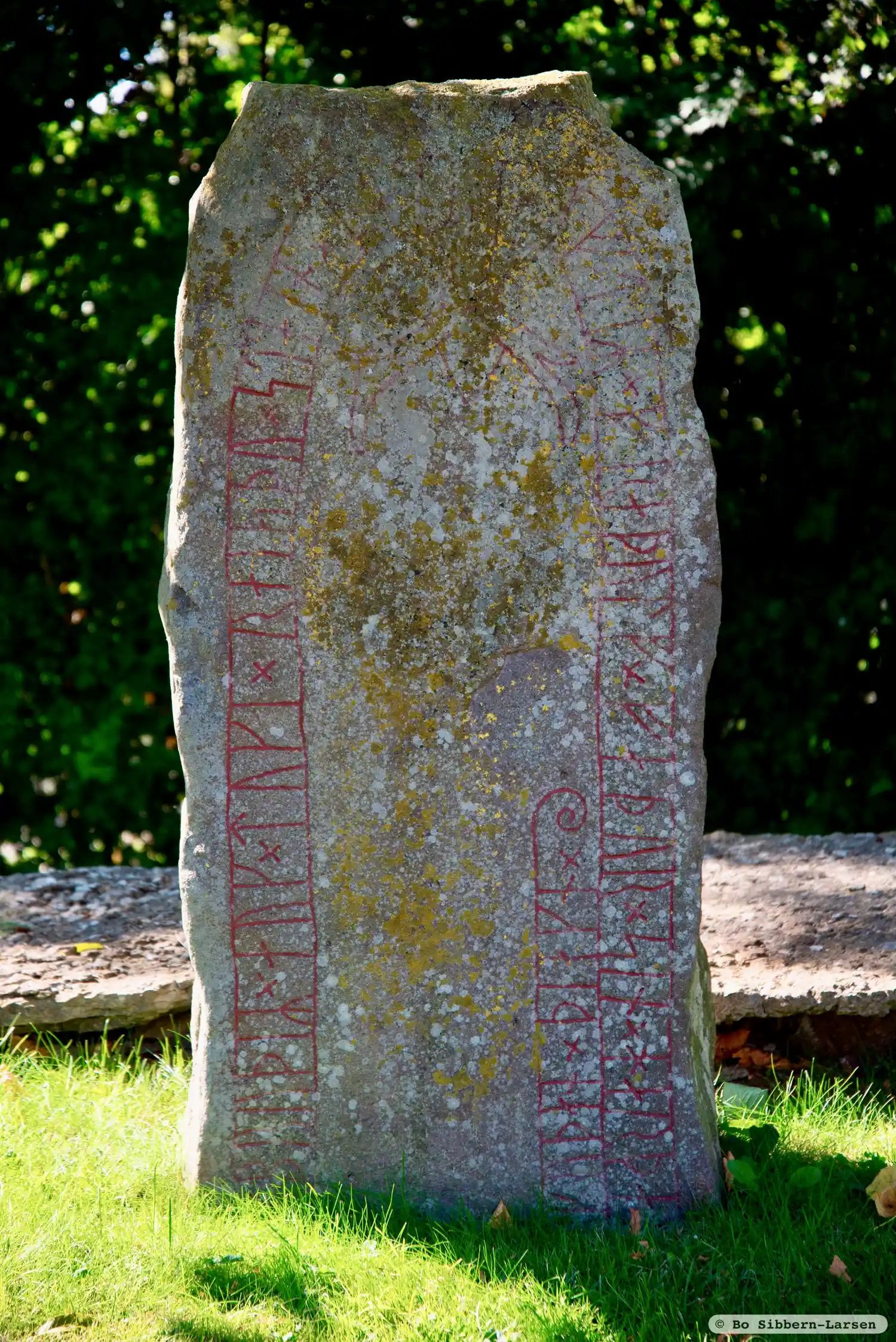
Photo: Bo Sibbern-Larsen
Runic inscription
÷ bruþiR × auk × tuki × raisþu × stain × þansi × aftiR × fraþulf × faþur × sin × harþa ÷ ¶ ÷ kuþan × þiakn ×
Inscription
÷ bruþiR × auk × tuki × raisþu × stain × þansi × aftiR × fraþulf × faþur × sin × harþa ÷ ¶ ÷ kuþan × þiakn ×
Translation
Bróðir and Tóki raised this stone in memory of Fraðulfr/Friðulfr, their father, a very good þegn.
Find the carving
Rune-stone DR343, L1990:4785 in Östra Herrestad parish, Simrishamn municipality
Facts
| Monument number | L1990:4785 |
|---|---|
| Swedish National Heritage Board ID | Östra Herrestad 5:1 |
| Carver | Ev. samma som gjort DR 293 och 294 |
| Status | Confirmed on location |
| Place | Visible above ground |
| Material | Sandstone |
| Period | Viking age |
| Antiquarian assessment | Ancient monument |
| Damage status | Unknown |
| County | Skåne |
| Municipality | Simrishamn |
| Parish | Östra Herrestad |
| Coordinates | 55.5260345, 14.165876 |
Sources
Most of the factual information in Runkartan comes from the Swedish National Heritage Board’s Fornsök data and from the Scandinavian Runic Text Database. The maps come from OpenStreetMap and Leaflet.js. The photographs were taken by the credited photographers.