Rune-stone DR317, L1988:5315 in Lund parish, Lund municipality
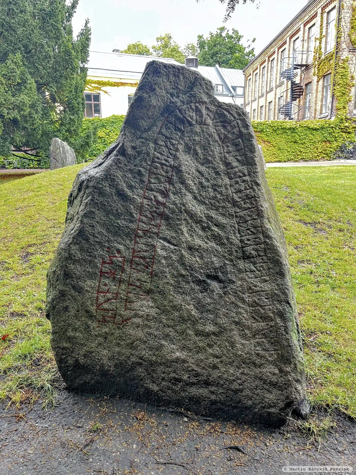
Photo: Martin Kåresjö Pessink
Runic inscription
· tufa : risþi : stino : þisi : uftiR : kamal : buta : sin : uk : osur : ¶ : sun : hs :
Inscription
· tufa : risþi : stino : þisi : uftiR : kamal : buta : sin : uk : osur : ¶ : sun : hs :
Translation
Tófa raised these stones in memory of Gamall, her husbandman, and (so did) Ôzurr, his son.
Find the carving
Rune-stone DR317, L1988:5315 in Lund parish, Lund municipality
Facts
| Monument number | L1988:5315 |
|---|---|
| Swedish National Heritage Board ID | Lund 9:4 |
| Status | Confirmed on location |
| Place | Visible above ground |
| Material | Granite |
| Period | Viking age |
| Antiquarian assessment | Ancient monument |
| Damage status | Undamaged |
| County | Skåne |
| Municipality | Lund |
| Parish | Lund |
| Coordinates | 55.7057735, 13.1947925 |
Sources
Most of the factual information in Runkartan comes from the Swedish National Heritage Board’s Fornsök data and from the Scandinavian Runic Text Database. The maps come from OpenStreetMap and Leaflet.js. The photographs were taken by the credited photographers.