Rune-stone DR294, L1988:17 in Baldringe parish, Ystad municipality
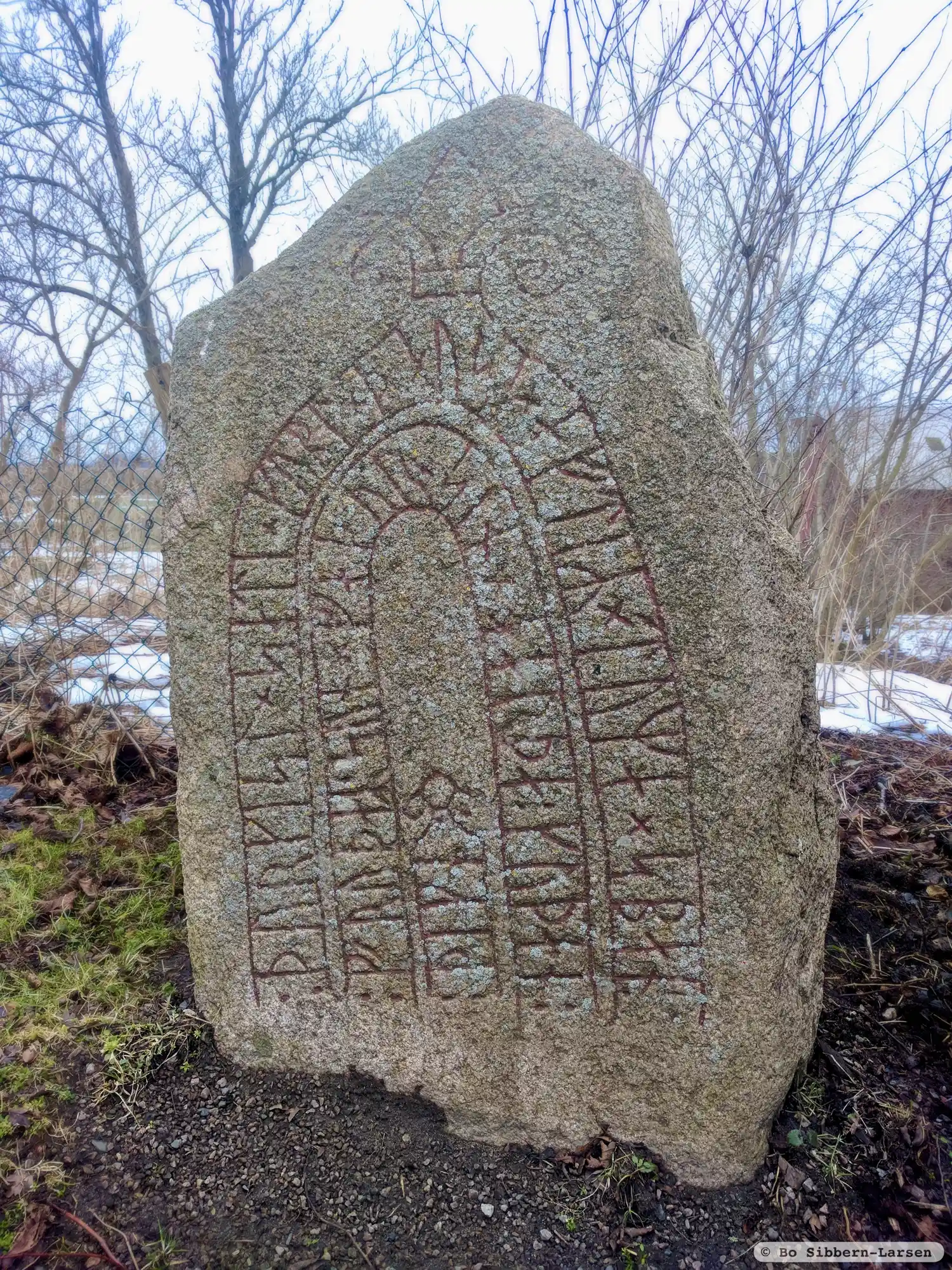
Photo: Bo Sibbern-Larsen
Runic inscription
÷ þurkisl × sati × kubl × þausi × aftiR × tuma × sban ÷ ¶ ÷ fruþaR ' sun × faþur × sin ÷ harþa ÷ kuþan ÷ ¶ ÷ þikn
Inscription
÷ þurkisl × sati × kubl × þausi × aftiR × tuma × sban ÷ ¶ ÷ fruþaR ' sun × faþur × sin ÷ harþa ÷ kuþan ÷ ¶ ÷ þikn
Translation
Þorgísl placed these monuments in memory of his father Tumi Foresighted/Chip, Frøðr's son, a very good þegn.
Find the carving
Rune-stone DR294, L1988:17 in Baldringe parish, Ystad municipality
Facts
| Monument number | L1988:17 |
|---|---|
| Swedish National Heritage Board ID | Baldringe 2:1 |
| Carver | Ev. samma som gjort DR 293 och 343 |
| Status | Confirmed on location |
| Place | Visible above ground |
| Material | Granite |
| Antiquarian assessment | Ancient monument |
| Damage status | Unknown |
| County | Skåne |
| Municipality | Ystad |
| Parish | Baldringe |
| Coordinates | 55.5298825, 13.839889 |
Sources
Most of the factual information in Runkartan comes from the Swedish National Heritage Board’s Fornsök data and from the Scandinavian Runic Text Database. The maps come from OpenStreetMap and Leaflet.js. The photographs were taken by the credited photographers.