Rune-stone DR288, L1988:5384 in Lund parish, Lund municipality
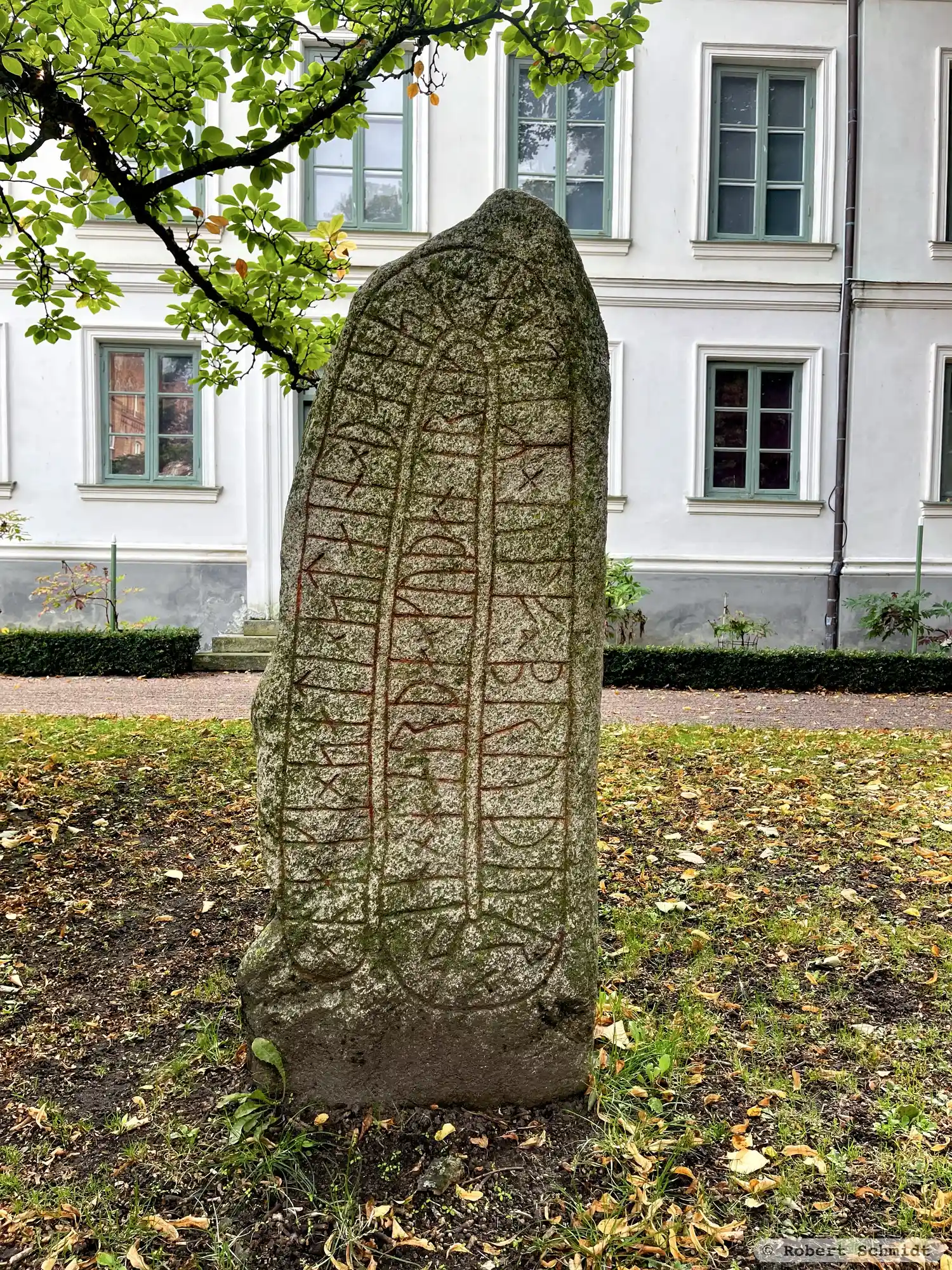
Photo: Robert Schmidt
Runic inscription
× oaki × sati × stain × þansi × aftiR × ulf × bruþur × sin × harþa × kuþan × trak ×
Inscription
× oaki × sati × stain × þansi × aftiR × ulf × bruþur × sin × harþa × kuþan × trak ×
Translation
Áki placed this stone in memory of Ulfr, his brother, a very good valiant man.
Find the carving
Rune-stone DR288, L1988:5384 in Lund parish, Lund municipality
Facts
| Monument number | L1988:5384 |
|---|---|
| Swedish National Heritage Board ID | Lund 11:6 |
| Carver | Troligen Hunnestad-ristaren |
| Status | Utgår på grund of felregistrering |
| Place | Visible above ground |
| Material | Granite |
| Antiquarian assessment | No antiquarian assessment |
| Damage status | Undamaged |
| County | Skåne |
| Municipality | Lund |
| Parish | Lund |
| Coordinates | 55.7046195, 13.196223 |
Sources
Most of the factual information in Runkartan comes from the Swedish National Heritage Board’s Fornsök data and from the Scandinavian Runic Text Database. The maps come from OpenStreetMap and Leaflet.js. The photographs were taken by the credited photographers.