Rune-stone DR277, L1989:8055 in Villie parish, Skurup municipality
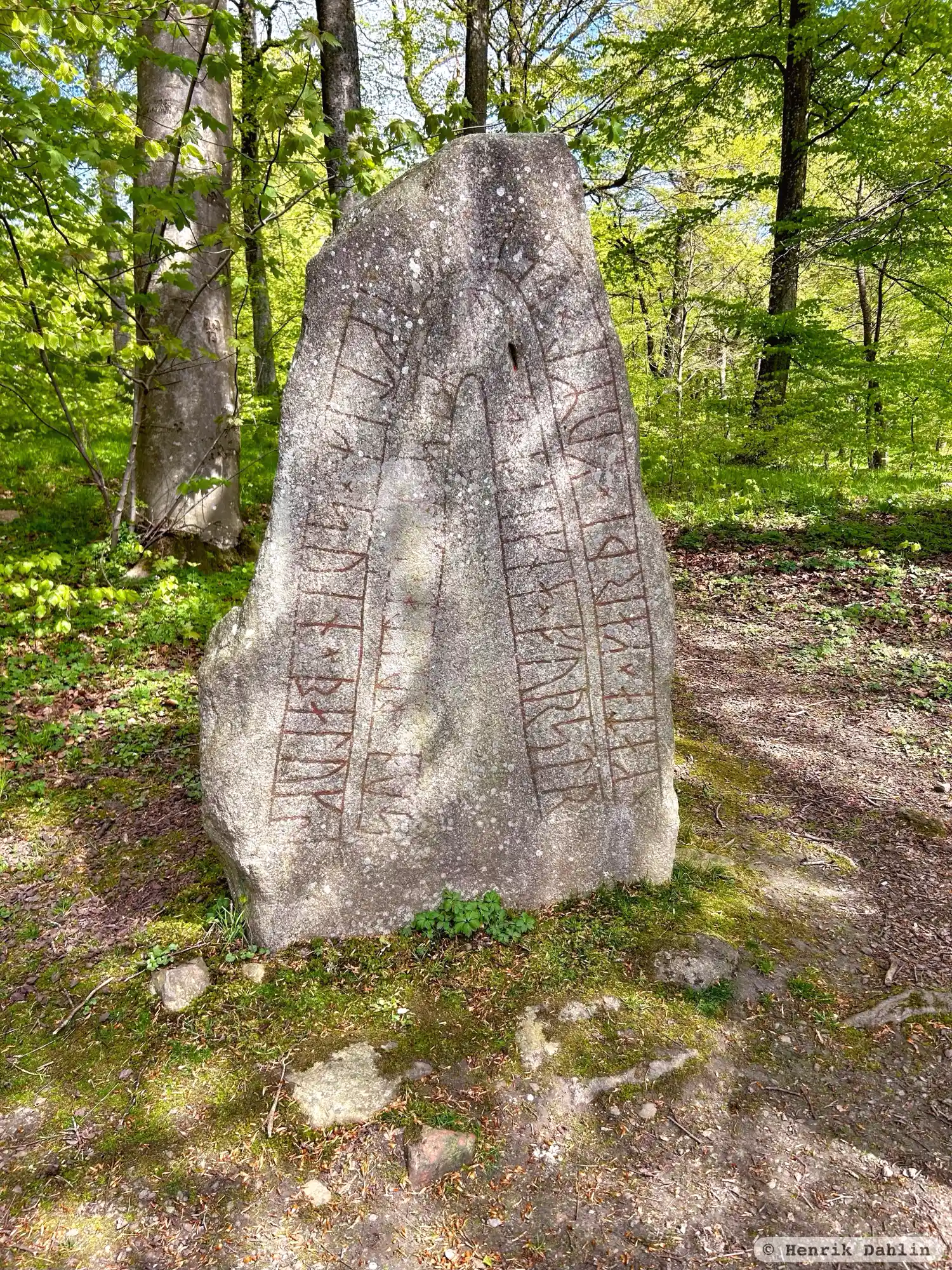
Photo: Henrik Dahlin
Runic inscription
× kata × karþi × kuml × þausi × iftiR × suin × baluks ¶ sun × bunta × sin × saR × uas × þiakna × furstr
Inscription
× kata × karþi × kuml × þausi × iftiR × suin × baluks ¶ sun × bunta × sin × saR × uas × þiakna × furstr
Translation
Káta made these monuments in memory of Sveinn Bôllungr's son, her husbandman. He was first among þegns.
Find the carving
Rune-stone DR277, L1989:8055 in Villie parish, Skurup municipality
Facts
| Monument number | L1989:8055 |
|---|---|
| Swedish National Heritage Board ID | Villie 4:1 |
| Status | Confirmed on location |
| Place | Visible above ground |
| Material | Granite |
| Antiquarian assessment | Ancient monument |
| Damage status | Undamaged |
| County | Skåne |
| Municipality | Skurup |
| Parish | Villie |
| Coordinates | 55.5131065, 13.596613 |
Sources
Most of the factual information in Runkartan comes from the Swedish National Heritage Board’s Fornsök data and from the Scandinavian Runic Text Database. The maps come from OpenStreetMap and Leaflet.js. The photographs were taken by the credited photographers.