Rune-stone DR268, L1989:3598 in Östra Vemmenhög parish, Skurup municipality
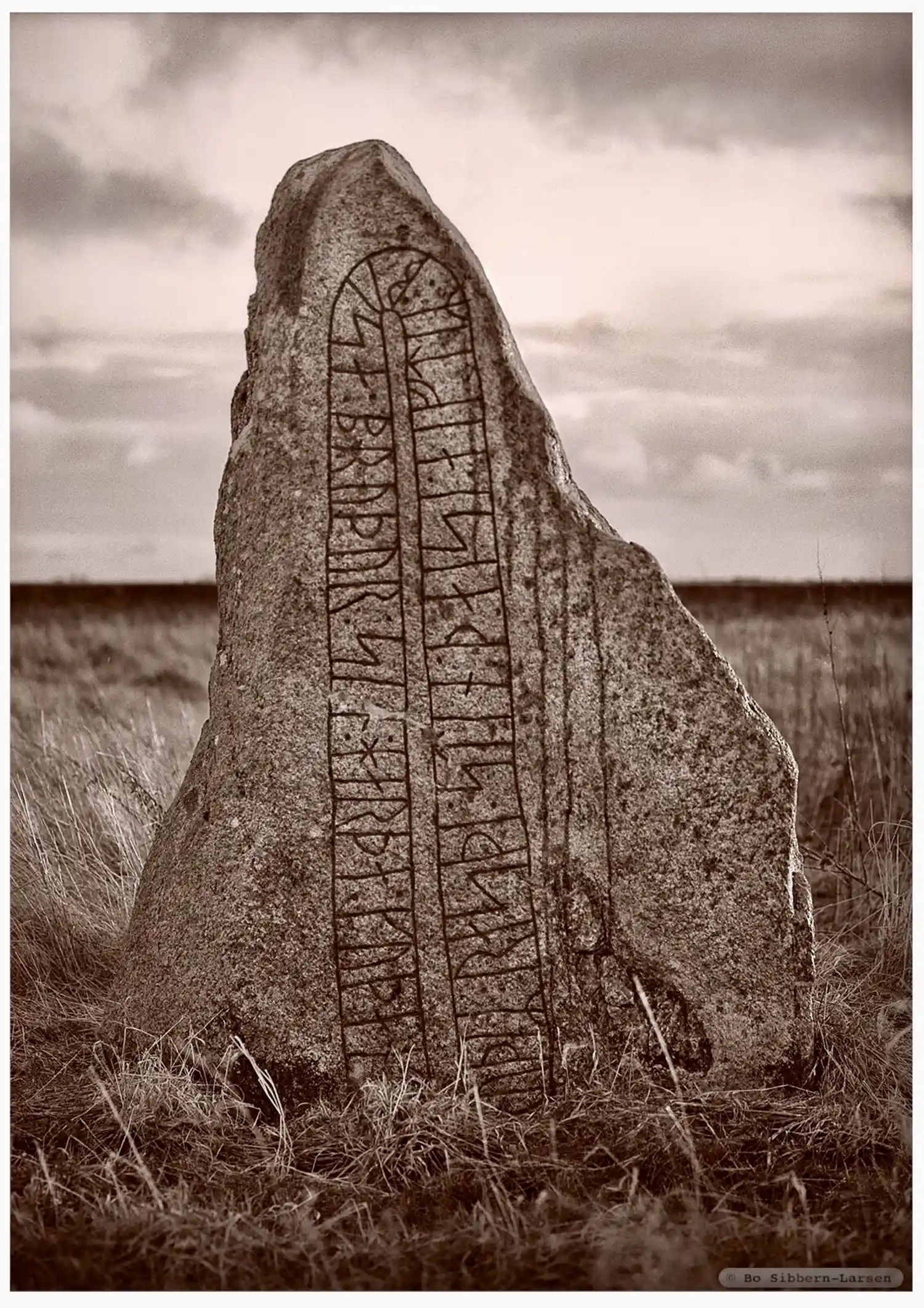
Photo: Bo Sibbern-Larsen
Runic inscription
bruþiR : rasþi : stin : þaisi : aiftiR : busa : bruþur : sin : harþa : kuþan : trik
Inscription
bruþiR : rasþi : stin : þaisi : aiftiR : busa : bruþur : sin : harþa : kuþan : trik
Translation
Bróðir raised this stone in memory of Bósi, his brother, a very good valiant man.
Find the carving
Rune-stone DR268, L1989:3598 in Östra Vemmenhög parish, Skurup municipality
Facts
| Monument number | L1989:3598 |
|---|---|
| Swedish National Heritage Board ID | Östra Vemmenhög 3:1 |
| Status | Confirmed on location |
| Place | Visible above ground |
| Material | Granite |
| Period | Viking age |
| Antiquarian assessment | Ancient monument |
| Damage status | Undamaged |
| County | Skåne |
| Municipality | Skurup |
| Parish | Östra Vemmenhög |
| Coordinates | 55.4163405, 13.508693 |
Sources
Most of the factual information in Runkartan comes from the Swedish National Heritage Board’s Fornsök data and from the Scandinavian Runic Text Database. The maps come from OpenStreetMap and Leaflet.js. The photographs were taken by the credited photographers.