Rune-stone Arkils tingstad, U226, L2014:2301 in Vallentuna parish, Vallentuna municipality
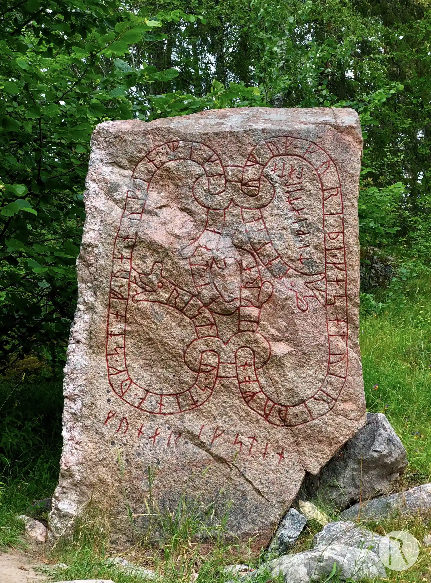
Photo: Niklas Vackerdag
Runic inscription
ristu · stina · uk · staf · uan · uk · in · mikla · at · iartiknum uk kuriþi · kas at · uiri · þu mon i krati · kiatit lata kunar ik stin
Inscription
ristu · stina · uk · staf · uan · uk · in · mikla · at · iartiknum uk kuriþi · kas at · uiri · þu mon i krati · kiatit lata kunar ik stin
Translation
(They) raised the stones and worked(?) the staff also, the mighty one, as marks of honour. Gyríðr also cherished her husband: he will therefore be commemorated in weeping. Gunnarr cut the stone.
Find the carving
Rune-stone Arkils tingstad, U226, L2014:2301 in Vallentuna parish, Vallentuna municipality
Facts
| Monument number | L2014:2301 |
|---|---|
| Swedish National Heritage Board ID | Vallentuna 225:1 |
| Carver | Gunnar (S) |
| Status | Confirmed on location |
| Place | Visible above ground |
| Material | Granite |
| Period | Viking age |
| Antiquarian assessment | Ancient monument |
| Damage status | Undamaged |
| County | Stockholm |
| Municipality | Vallentuna |
| Parish | Vallentuna |
| Coordinates | 59.5158456, 18.0530738 |
Sources
Most of the factual information in Runkartan comes from the Swedish National Heritage Board’s Fornsök data and from the Scandinavian Runic Text Database. The maps come from OpenStreetMap and Leaflet.js. The photographs were taken by the credited photographers.