Runic rock inscription U90, L2017:8833 in Järfälla parish, Järfälla municipality
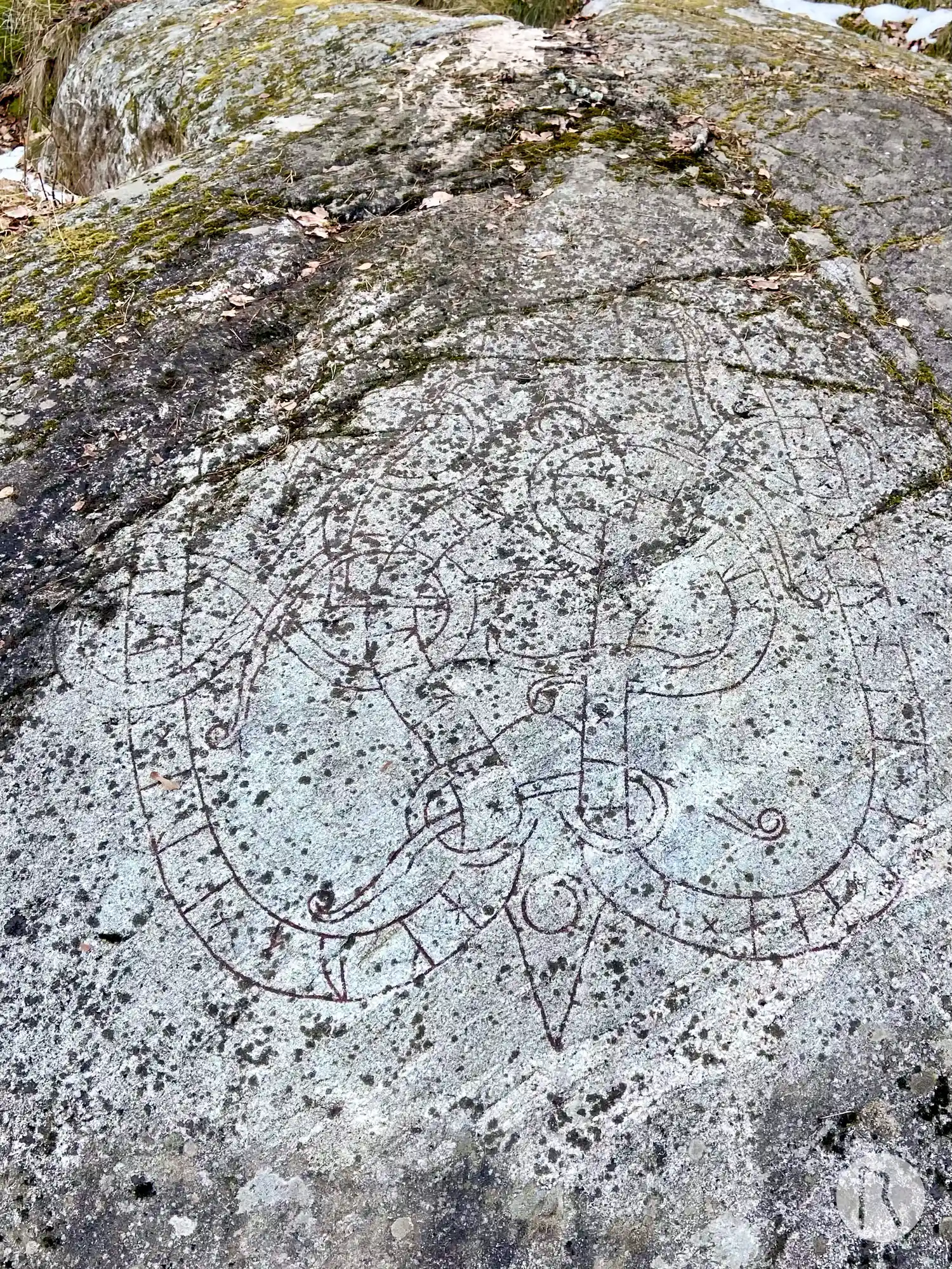
Photo: Niklas Vackerdag
Runic inscription
× uifiriR × lit × hkua × ili × þisa × eftiR × brþur × sin × þerf × auk × munti × at × mah × sin ×
Inscription
× uifiriR × lit × hkua × ili × þisa × eftiR × brþur × sin × þerf × auk × munti × at × mah × sin ×
Translation
Véfríðr had this rock-slab cut in memory of his brother Þerfr; and Mundi in memory of his kinsman-by-marriage.
Find the carving
Runic rock inscription U90, L2017:8833 in Järfälla parish, Järfälla municipality
Facts
| Monument number | L2017:8833 |
|---|---|
| Swedish National Heritage Board ID | Järfälla 103:1 |
| Carver | Olev (A); Fot 2 (A); Ärnfast (A) |
| Status | Confirmed on location |
| Place | Visible above ground |
| Period | Viking age |
| Antiquarian assessment | Ancient monument |
| Damage status | Unknown |
| County | Stockholm |
| Municipality | Järfälla |
| Parish | Järfälla |
| Coordinates | 59.425561, 17.8605 |
Sources
Most of the factual information in Runkartan comes from the Swedish National Heritage Board’s Fornsök data and from the Scandinavian Runic Text Database. The maps come from OpenStreetMap and Leaflet.js. The photographs were taken by the credited photographers.