Runic rock inscription U59, L2013:1861 in Stockholm parish, Stockholm municipality
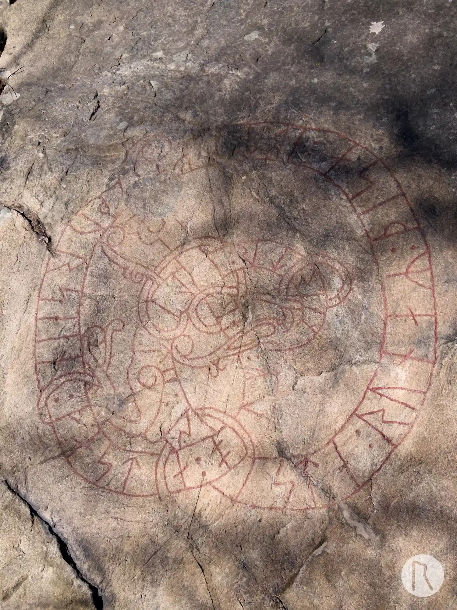
Photo: Niklas Vackerdag
Runic inscription
neistr : lit : rista : runaR : þisa : ebti · faþur sein : fasta : olf : aik
Inscription
neistr : lit : rista : runaR : þisa : ebti · faþur sein : fasta : olf : aik
Translation
Næstr(?) had these runes carved in memory of his father Fasti ...
Find the carving
Runic rock inscription U59, L2013:1861 in Stockholm parish, Stockholm municipality
Facts
| Monument number | L2013:1861 |
|---|---|
| Swedish National Heritage Board ID | Bromma 13:2 |
| Carver | Ulv 2 (S); Fastulv 2 ? (S) |
| Status | Confirmed on location |
| Place | Visible above ground |
| Material | Gneissgranite |
| Antiquarian assessment | Ancient monument |
| Damage status | Unknown |
| County | Stockholm |
| Municipality | Stockholm |
| Parish | Stockholm |
| Coordinates | 59.3389875, 17.9447815 |
Sources
Most of the factual information in Runkartan comes from the Swedish National Heritage Board’s Fornsök data and from the Scandinavian Runic Text Database. The maps come from OpenStreetMap and Leaflet.js. The photographs were taken by the credited photographers.