Runic rock inscription Ög43, L2009:5612 in Norrköping parish, Norrköping municipality
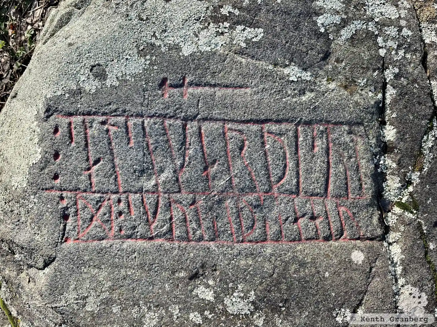
Photo: Kenth Granberg
Runic inscription
÷ salsi karþi sul ¶ ÷ D ÷ skut-- þ--a hiu
Inscription
÷ salsi karþi sul ¶ ÷ D ÷ skut-- þ--a hiu
Translation
Sôlsi made the sun. Dagr(?) cut this ...
Find the carving
Runic rock inscription Ög43, L2009:5612 in Norrköping parish, Norrköping municipality
Facts
| Monument number | L2009:5612 |
|---|---|
| Swedish National Heritage Board ID | Östra Eneby 62:1 |
| Status | Confirmed on location |
| Place | Visible above ground |
| Antiquarian assessment | Ancient monument |
| Damage status | Undamaged |
| County | Östergötland |
| Municipality | Norrköping |
| Parish | Norrköping |
| Coordinates | 58.6121725, 16.172472 |
Sources
Most of the factual information in Runkartan comes from the Swedish National Heritage Board’s Fornsök data and from the Scandinavian Runic Text Database. The maps come from OpenStreetMap and Leaflet.js. The photographs were taken by the credited photographers.