Runic rock inscription Gökstenen, Sö327, L1984:2827 in Härad parish, Strängnäs municipality
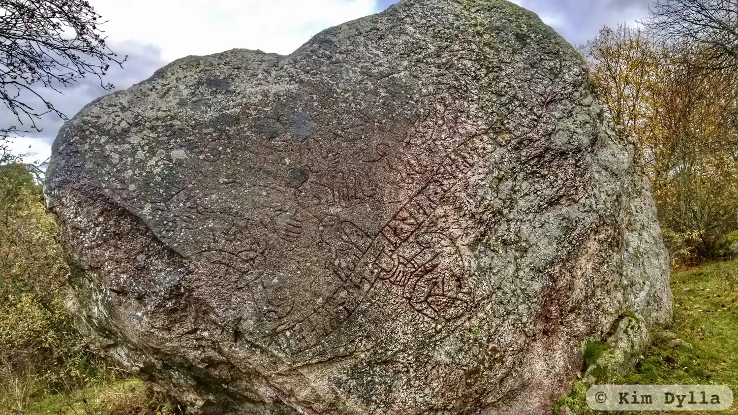
Photo: Kim Dylla
Runic inscription
... (i)uraRi : kaum : isaio : raisti : stai : ain : þansi : at : : þuaR : fauþr : sloþn : kbrat : sin faþu... ul(i) · hano : msi +
Inscription
... (i)uraRi : kaum : isaio : raisti : stai : ain : þansi : at : : þuaR : fauþr : sloþn : kbrat : sin faþu... ul(i) · hano : msi +
Translation
...
Find the carving
Runic rock inscription Gökstenen, Sö327, L1984:2827 in Härad parish, Strängnäs municipality
Facts
| Monument number | L1984:2827 |
|---|---|
| Swedish National Heritage Board ID | Härad 53:2 |
| Carver | Troligen samma ristare som gjort Sö 324. |
| Status | Confirmed on location |
| Place | Visible above ground |
| Antiquarian assessment | Ancient monument |
| Damage status | Damage |
| County | Södermanland |
| Municipality | Strängnäs |
| Parish | Härad |
| Coordinates | 59.3728515, 16.9304935 |
Sources
Most of the factual information in Runkartan comes from the Swedish National Heritage Board’s Fornsök data and from the Scandinavian Runic Text Database. The maps come from OpenStreetMap and Leaflet.js. The photographs were taken by the credited photographers.