Runic rock inscription G65, L1976:6142 in Sproge parish, Gotland municipality
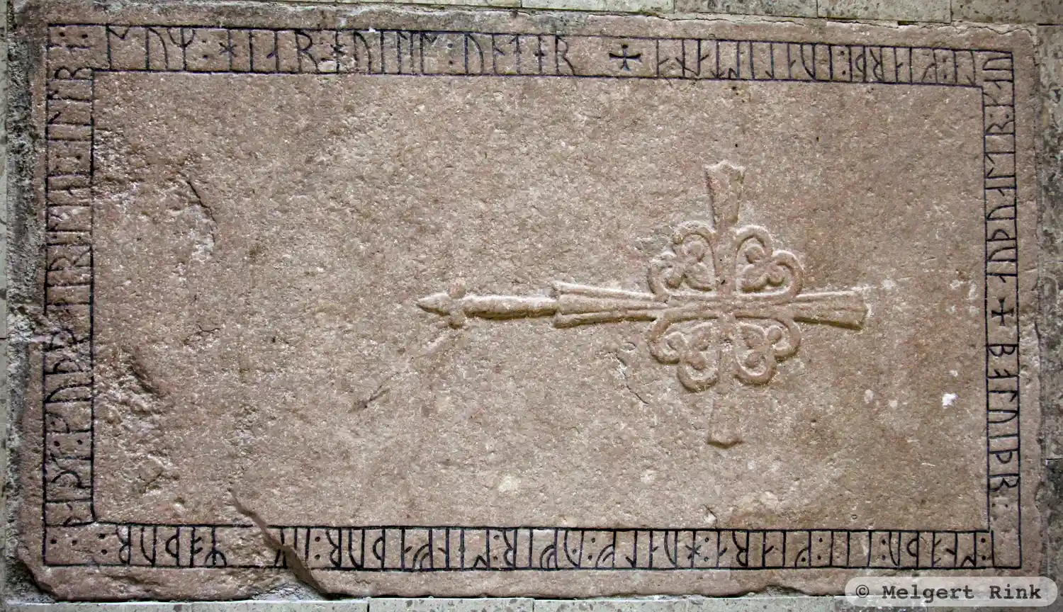
Photo: Melgert Rink
Runic inscription
÷ boluiþr : i : snoþu : (l)i(t) : giara : hualf : yfir : sen faþur : (u)[k] moþur :: naþi : guþ : þaira : sial : allra : sum : hiar : huilis : under ÷ auþualtr : kauli : giarþi : -ua lis(t)ana
Inscription
÷ boluiþr : i : snoþu : (l)i(t) : giara : hualf : yfir : sen faþur : (u)[k] moþur :: naþi : guþ : þaira : sial : allra : sum : hiar : huilis : under ÷ auþualtr : kauli : giarþi : -ua lis(t)ana
Translation
Bótviðr Snoðr/Snoder had the vault made over her father and mother. May God be gracious to all their souls, those who rest hereunder. Auðvaldr Gauti(?) made two tomb-stones(?).
Find the carving
Runic rock inscription G65, L1976:6142 in Sproge parish, Gotland municipality
Facts
| Monument number | L1976:6142 |
|---|---|
| Swedish National Heritage Board ID | Sproge 65:1 |
| Carver | Audvald göte(?) (S) |
| Status | Confirmed on location |
| Place | Visible above ground |
| Material | Limestone? |
| Antiquarian assessment | Other cultural-historical relic |
| Damage status | Unknown |
| County | Gotland |
| Municipality | Gotland |
| Parish | Sproge |
| Coordinates | 57.2536315, 18.211059 |
Sources
Most of the factual information in Runkartan comes from the Swedish National Heritage Board’s Fornsök data and from the Scandinavian Runic Text Database. The maps come from OpenStreetMap and Leaflet.js. The photographs were taken by the credited photographers.