Runic inscription U967, L1941:4005 in Vaksala parish, Uppsala municipality
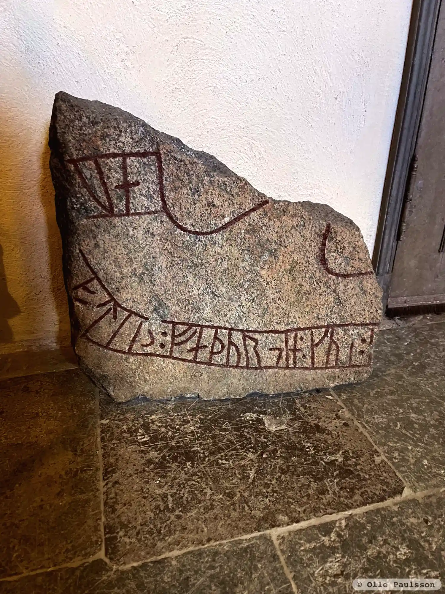
Photo: Olle Paulsson
Runic inscription
... -au... ...fti(r) : faþur (s)in : ku- (:) -...
Inscription
... -au... ...fti(r) : faþur (s)in : ku- (:) -...
Translation
... in memory of his father ...
Find the carving
Runic inscription U967, L1941:4005 in Vaksala parish, Uppsala municipality
Facts
| Monument number | L1941:4005 |
|---|---|
| Swedish National Heritage Board ID | Vaksala 241:2 |
| Carver | (Öpir 1 (A)) [för få runor för attr., Åhlén 1997] [felaktigt, tryckfel i SRI] |
| Status | Confirmed on location |
| Place | Visible above ground |
| Material | Greyred granite |
| Period | Viking age |
| Antiquarian assessment | Possible ancient monument |
| Damage status | Unknown |
| County | Uppsala |
| Municipality | Uppsala |
| Parish | Vaksala |
| Coordinates | 59.876041, 17.686119 |
Sources
Most of the factual information in Runkartan comes from the Swedish National Heritage Board’s Fornsök data and from the Scandinavian Runic Text Database. The maps come from OpenStreetMap and Leaflet.js. The photographs were taken by the credited photographers.