Runic inscription Sö337, L2002:1638 in Torpa parish, Kungsör municipality
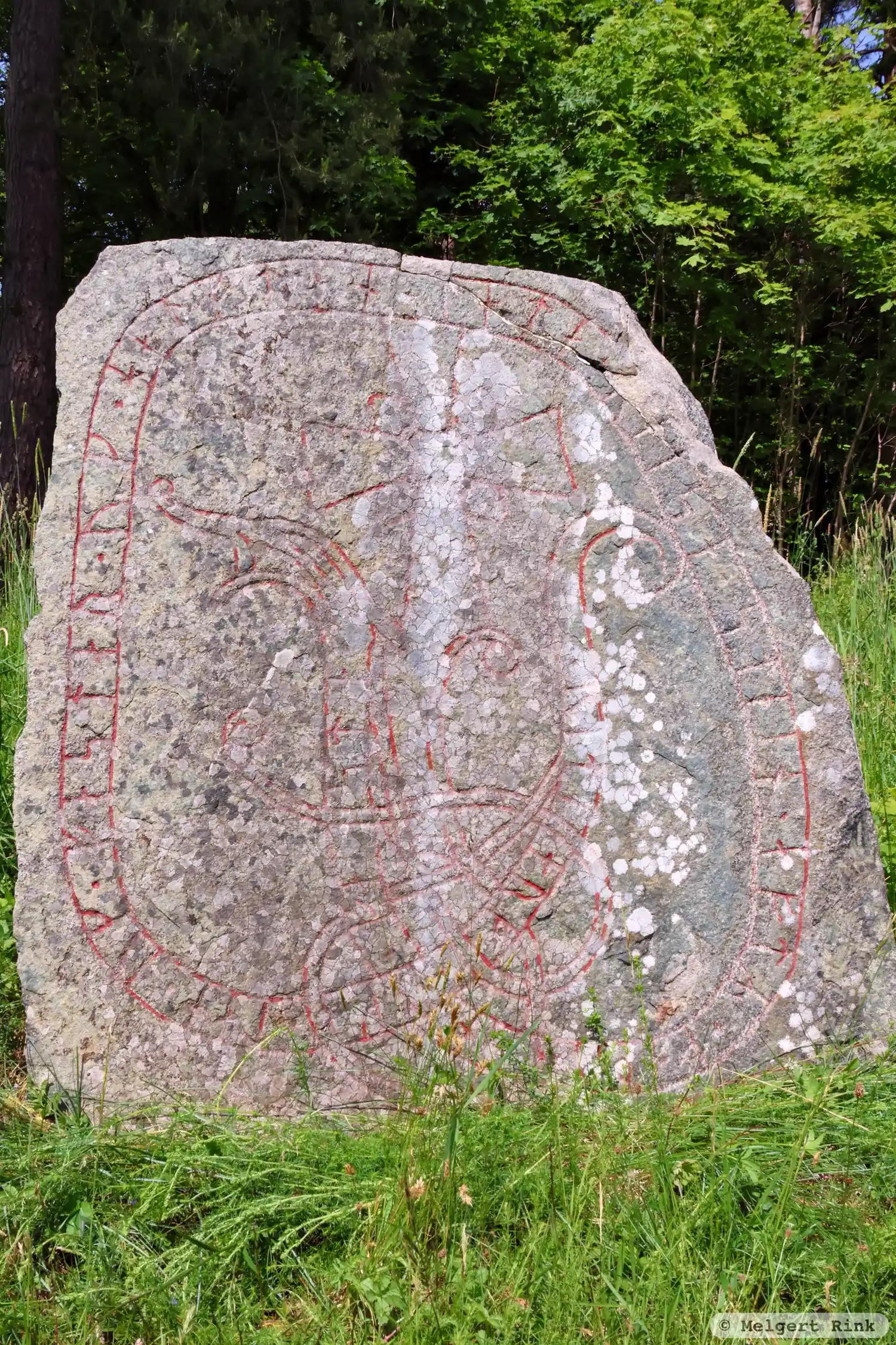
Photo: Melgert Rink
Runic inscription
+ øþu(l)fær : (k)ærþe ki(r)(i)k(i)(u)
Inscription
+ øþu(l)fær : (k)ærþe ki(r)(i)k(i)(u)
Translation
Auðulfr made the church.
Find the carving
Runic inscription Sö337, L2002:1638 in Torpa parish, Kungsör municipality
Facts
| Monument number | L2002:1638 |
|---|---|
| Swedish National Heritage Board ID | Torpa 13:1 |
| Status | Confirmed on location |
| Place | Visible above ground |
| Antiquarian assessment | Other cultural-historical relic |
| Damage status | Damage |
| County | Västmanland |
| Municipality | Kungsör |
| Parish | Torpa |
| Coordinates | 59.4218295, 16.1867975 |
Sources
Most of the factual information in Runkartan comes from the Swedish National Heritage Board’s Fornsök data and from the Scandinavian Runic Text Database. The maps come from OpenStreetMap and Leaflet.js. The photographs were taken by the credited photographers.