Runic inscription Sö293, L2017:8479 in Grödinge parish, Botkyrka municipality
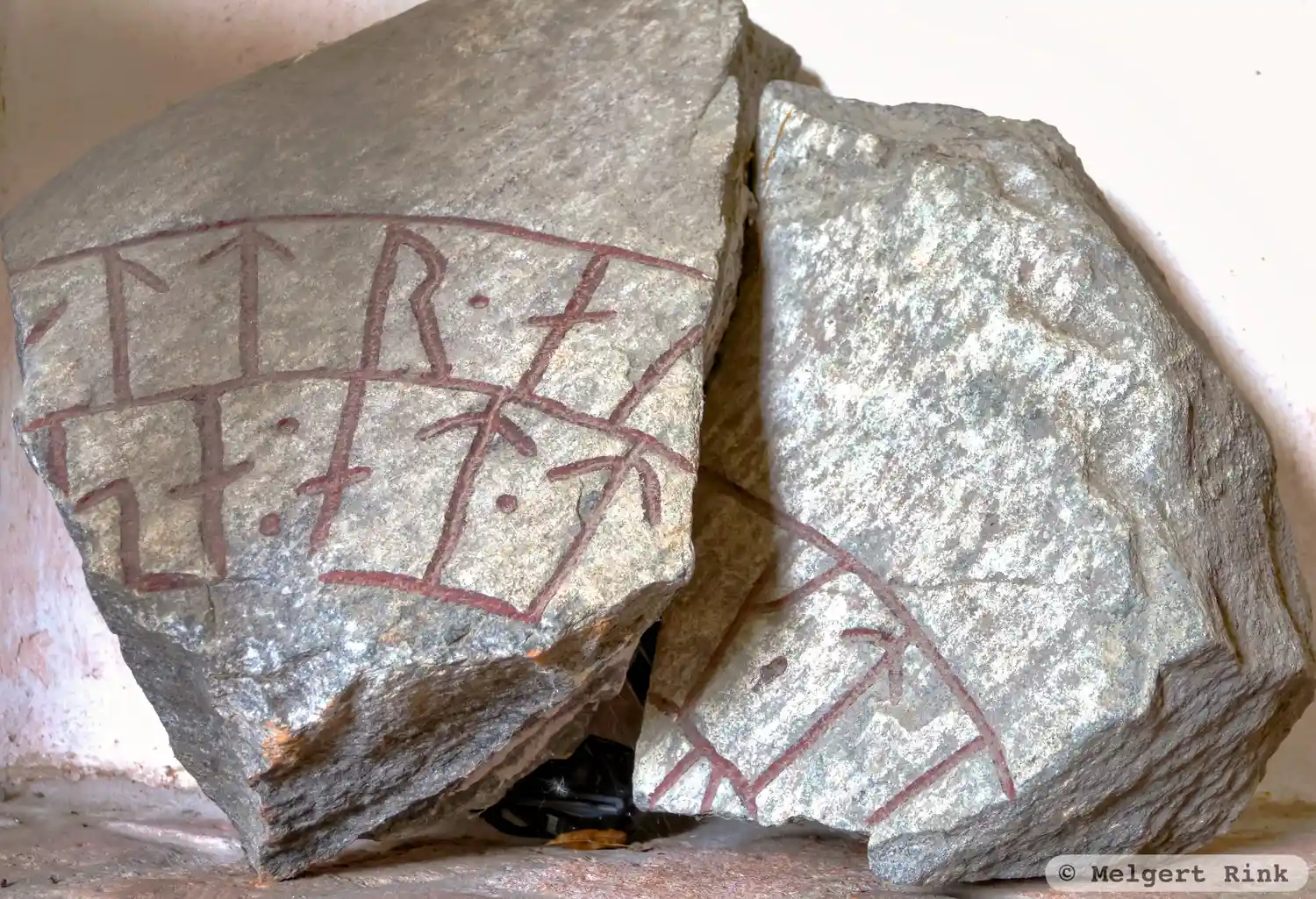
Photo: Melgert Rink
Runic inscription
[auintr : auk : kerþar : auk : iki](a)ltr · auk · ti[þkumi : auk : sikraif · þaiR : raistu : stain : þin]sa : at · tu[li : faþur : sin]
Inscription
[auintr : auk : kerþar : auk : iki](a)ltr · auk · ti[þkumi : auk : sikraif · þaiR : raistu : stain : þin]sa : at · tu[li : faþur : sin]
Translation
Eyvindr and Gerðarr and Ingjaldr and Tíðkumi and Sigreifr, they raised this stone in memory of Tólir, their father.
Find the carving
Runic inscription Sö293, L2017:8479 in Grödinge parish, Botkyrka municipality
Facts
| Monument number | L2017:8479 |
|---|---|
| Swedish National Heritage Board ID | Grödinge 60:2 |
| Status | Confirmed on location |
| Place | Visible above ground |
| Material | Granitee |
| Antiquarian assessment | Other cultural-historical relic |
| Damage status | Unknown |
| County | Stockholm |
| Municipality | Botkyrka |
| Parish | Grödinge |
| Coordinates | 59.1434135, 17.7868275 |
Sources
Most of the factual information in Runkartan comes from the Swedish National Heritage Board’s Fornsök data and from the Scandinavian Runic Text Database. The maps come from OpenStreetMap and Leaflet.js. The photographs were taken by the credited photographers.