Runic inscription in grave context ÖgFv1959;97, L2010:3372 in Norrköping parish, Norrköping municipality
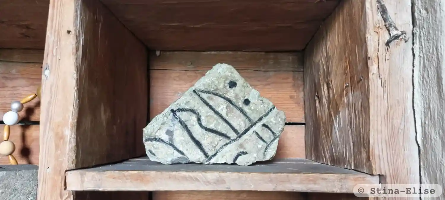
Photo: Stina-Elise
Runic inscription
§A ...uru : ... §B ...-k : ku-...
Inscription
§A ...uru : ... §B ...-k : ku-...
Translation
§A ... §B ...
Find the carving
Runic inscription in grave context ÖgFv1959;97, L2010:3372 in Norrköping parish, Norrköping municipality
Facts
| Monument number | L2010:3372 |
|---|---|
| Swedish National Heritage Board ID | Tingstad 25:4 |
| Status | Confirmed on location |
| Place | Visible above ground |
| Material | Limestone? |
| Antiquarian assessment | Other cultural-historical relic |
| Damage status | Damage |
| County | Östergötland |
| Municipality | Norrköping |
| Parish | Norrköping |
| Coordinates | 58.5292755, 16.291513 |
Sources
Most of the factual information in Runkartan comes from the Swedish National Heritage Board’s Fornsök data and from the Scandinavian Runic Text Database. The maps come from OpenStreetMap and Leaflet.js. The photographs were taken by the credited photographers.